AKA: none
Other ID: M-W5-88-CP,MW8805
Status: Completed
Organization(s): USGS, Pacific Coastal and Marine Science Center
Funding Program(s):
Principal Investigator(s):
Affiliate Investigator(s):
Information Specialist(s): James Hein
Data Type(s): Location-Elevation: Navigation, Sampling: Geology
Scientific Purpose/Goals:
Vehicle(s):
Start Port/Location:
End Port/Location:
Start Date: 1988-01-01
End Date: 1988-01-01
Equipment Used: navigation, samples
Information to be Derived: XRD mineral analyses
Summary of Activity and Data Gathered:
Staff:
Affiliate Staff:
Notes:
Location:
Marshall Islands
| Boundaries | |||
|---|---|---|---|
| North: 24.44714959 | South: 3.42569152 | West: 158.64257813 | East: 174.90234375 |
Platform(s):
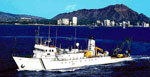 Moana Wave |
| Survey Equipment | Survey Info | Data Type(s) | Data Collected |
|---|---|---|---|
| navigation | --- | Navigation | |
| samples | --- | Biology Chemistry Geology |
