AKA: NT10-12
Other ID: N-1-10-WP,Pacific EEZ Mineral
Status: Completed
Organization(s): National Oceanic and Atmospheric Administration, Japan Agency for Marine-Earth Science and Technology, University of Texas, Dallas, USGS, Pacific Coastal and Marine Science Center
Funding Program(s): Island arc volcanism and mineralization (MU152)
Principal Investigator(s): James Hein
Affiliate Investigator(s): Y. Tamura, Robert Stern, Bob Embley
Information Specialist(s): James Hein
Data Type(s): Imagery: Photo, Location-Elevation: Navigation, Sampling: Chemistry, Sonar: Single Beam
Scientific Purpose/Goals: Volcanic history and mineralization of the volcanic arc
Vehicle(s):
Start Port/Location: Guam
End Port/Location: Guam
Start Date: 2010-07-09
End Date: 2010-07-19
Equipment Used: camera, navigation, samples, bathymetry
Information to be Derived: Photos, mapping, chemistry, mineralogy
Summary of Activity and Data Gathered:
Staff:
Affiliate Staff:
Notes: Cruise report at;
http://www.godac.jamstec.go.jp/catalog/data/doc_catalog/media/NT10-12_all.pdf
Location:
Guam
| Boundaries | |||
|---|---|---|---|
| North: 59.75 | South: -19.75 | West: 105.25 | East: 179.75 |
Platform(s):
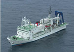 Natsushima |
Hein, J.R., de Ronde, C.E.J., Koski, R.A., Ditchburn, R.G., Mizell, K., Tamura, Y., Stern, R.J., Conrad, T.A., Ishizuka, O., Leybourne, M.I., 2014, Layered Hydrothermal Barite-Sulfide Mound Field, East Diamante Caldera, Mariana Volcanic Arc: Economic Geology, v. 109 no. 8, pp. 2179–2206, doi: 10.2113/econgeo.109.8.2179.
| Survey Equipment | Survey Info | Data Type(s) | Data Collected |
|---|---|---|---|
| camera | --- | Photo | |
| navigation | --- | Navigation | |
| samples | --- | Biology Chemistry Geology | |
| bathymetry | --- | Single Beam |
