AKA: none
Other ID: N-17-05-WP
Status: Completed
Organization(s): Japan Agency for Marine-Earth Science and Technology
Funding Program(s):
Principal Investigator(s):
Affiliate Investigator(s):
Information Specialist(s):
Data Type(s): Location-Elevation: Navigation, Sampling: Geology
Scientific Purpose/Goals: study volcanism and sedimentation near the southern end of the active Izu-Bonin-Mariana arc
Vehicle(s):
Start Port/Location:
End Port/Location:
Start Date: 2005-10-08
End Date: 2005-10-20
Equipment Used: navigation, Remotely Operated Vehicle
Information to be Derived:
Summary of Activity and Data Gathered:
Staff:
Affiliate Staff:
Notes: Dive 480 - 489, ROV Hyper-dolphin, sample locations in cruise reoprt.
Location:
Mariana Arc
| Boundaries | |||
|---|---|---|---|
| North: 59.75 | South: -19.75 | West: 105.25 | East: 179.75 |
Platform(s):
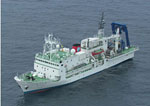 Natsushima |
| Survey Equipment | Survey Info | Data Type(s) | Data Collected |
|---|---|---|---|
| navigation | --- | Navigation | |
| Remotely Operated Vehicle | --- | Photo Video Biology Chemistry Geology |
