AKA: none
Other ID: O-1-00-GM,OS-00-GM
Status: Completed
Organization(s):
Funding Program(s): Pacific Seafloor Mapping Project (ZP000LD)
Principal Investigator(s): Jim Gardner
Affiliate Investigator(s):
Information Specialist(s): Peter Dartnell
Data Type(s): Environmental Data: CTD, Location-Elevation: Navigation, Seismics: Ocean Bottom Seismometer, Sonar: Multibeam, Sonar: Sidescan
Scientific Purpose/Goals: Map the location and distribution of deep-water corals in the Pinnacles area.
Vehicle(s):
Start Port/Location: Venice, Los Angeles, CA
End Port/Location: Venice, Los Angeles, CA
Start Date: 2000-05-23
End Date: 2000-06-09
Equipment Used: motionsensor, sidescansonar, multibeam, GPS, CTD
Information to be Derived: Bathymetry and calibrated acoustic backscatter
Summary of Activity and Data Gathered: Map the location and distribution of deep-water corals in the Pinnacles area using high-resolution multibeam bathymetry and acoustic backscatter.
Staff: Roland Arsenault, Peter Dartnell, Laurent Hellequin
Affiliate Staff:
Brian Calder (University New Hampshire) - Unspecified
Notes: For raw and intermediate data sets, contact Rani Nandiwada
Staff information imported from InfoBank
Jim Gardner (USGS Western Region) - Chief Scientist
Pete Dartnell (USGS Western Region) - Unspecified
Laurent Hellequin (University New Hampshire) - Unspecified
Brian Calder (University New Hampshire) - Unspecified
Roland Arsenault (University New Hampshire) - Unspecified
Location:
Gulf of America (Gulf of Mexico)
| Boundaries | |||
|---|---|---|---|
| North: 29.6 | South: 29.15 | West: -88.5333 | East: -87.35 |
Platform(s):
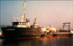 Ocean Surveyor |
Gardner, J.V., Sulak, K.J., Dartnell, P., Hellequin, L., Calder, B., and Mayer, L.A., 2000, Cruise Report RV Ocean Surveyor Cruise O-1-00-GM: The Bathymetry and Acoustic Backscatter of the Pinnacles Area, Northern Gulf of Mexico, May 23, through June 10, 2000 Venice, LA to Venice, LA: U.S. Geological Survey Open-File Report 00-350, https://doi.org/10.3133/ofr00350.
| Survey Equipment | Survey Info | Data Type(s) | Data Collected |
|---|---|---|---|
| motionsensor | --- | Ocean Bottom Seismometer | |
| sidescansonar | --- | Sidescan | |
| multibeam | --- | Multibeam | File list |
| GPS | --- | Navigation | |
| CTD | --- | Surveys (geochemical) Experiments (geochemical) CTD |
