AKA: none
Other ID: O-1-02-GM,OS-02-GM
Status: Completed
Organization(s): USGS, Pacific Coastal and Marine Science Center, C&C Technologies, Inc., University of New Brunswick
Funding Program(s): Pacific Seafloor Mapping Project (ZP000LD)
Principal Investigator(s): Jim Gardner
Affiliate Investigator(s): Jonathan Beaudoin (University of New Brunswick)
Information Specialist(s): Peter Dartnell
Data Type(s): Environmental Data: CTD, Location-Elevation: Navigation, Seismics: Ocean Bottom Seismometer, Sonar: Multibeam, Sonar: Sidescan
Scientific Purpose/Goals: Map specific areas on the outer continental shelf, northwestern Gulf of Mexico. These data should prove extremely useful in relating dominant species groups (which display highly specific biotope affinities) to the geomorphology (e.g., reef flattop, forereef crest, reef wall, reef base, circum-reef talus zone, circum-reef, high-reflectivity sediment apron, etc.).
Vehicle(s):
Start Port/Location: Iberia, LA
End Port/Location: Iberia, LA
Start Date: 2002-06-08
End Date: 2002-06-28
Equipment Used: GPS, sidescansonar, multibeam, motionsensor, CTD, acousticbackscatter
Information to be Derived: Bathymetry and calibrated, co-registered acoustic backscatter
Summary of Activity and Data Gathered:
Staff: Johnny Alcina, Ricky Businelle
Affiliate Staff:
Douglas Cartwright (University of New Brunswick) - Watch Stander
Anya Duxfield (University of New Brunswick) - Watch Stander
Jennifer Copppola (University of New Brunswick) - Watch Stander
Curtis Callaway (C&C Technologies
Inc.) - Party Chief
Lon Theriot (C&C Technologies
Inc.) - Surveyors
Ryan Poff (C&C Technologies
Inc.) - Surveyor
Balbir Bains (C&C Technologies
Inc.) - Surveyor
Leo Lopez - Captain
Notes: For raw and intermediate data sets, contact Rani Nandiwada
Staff information imported from InfoBank
Jonathan Beaudoin (University of New Brunswick) - Chief Scientist
Douglas Cartwright (University of New Brunswick) - Watch Stander
Anya Duxfield (University of New Brunswick) - Watch Stander
Jennifer Copppola (University of New Brunswick) - Watch Stander
Curtis Callaway (C&C Technologies, Inc.) - Party Chief
Lon Theriot (C&C Technologies, Inc.) - Surveyors
Ryan Poff (C&C Technologies, Inc.) - Surveyor
Chen (Surveyor, C&C Technologies, Inc.) - wei Wu
Balbir Bains (C&C Technologies, Inc.) - Surveyor
Johnny Alcina - Captain
Ricky Businelle - Captain
Leo Lopez - Captain
Location:
Northwest Gulf of Mexico
| Boundaries | |||
|---|---|---|---|
| North: 28.36667 | South: 27.78333 | West: -94.3333 | East: -91.55 |
Platform(s):
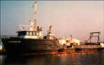 Ocean Surveyor |
Beaudoin, J.D., Gardner, J.V., and Clarke, J.E.H., 2002, Cruise Report: R/V Ocean Surveyor Cruise O1-02-GM: Bathymetry and Acoustic Backscatter of Selected Areas of the Outer Continental Shelf, Northwestern Gulf of Mexico: U.S. Geological Survey Open-File Report 02-410, http://pubs.usgs.gov/of/2002/0410/.
| Survey Equipment | Survey Info | Data Type(s) | Data Collected |
|---|---|---|---|
| GPS | --- | Navigation | |
| sidescansonar | --- | Sidescan | |
| multibeam | --- | Multibeam | File list |
| motionsensor | --- | Ocean Bottom Seismometer | |
| CTD | --- | Surveys (geochemical) Experiments (geochemical) CTD | |
| acousticbackscatter | --- | Sidescan |
