AKA: none
Other ID: KODOS_97-4,O-1-97-CP
Status: Completed
Organization(s): USGS, Pacific Coastal and Marine Science Center, Korea Ocean Research and Development Institute
Funding Program(s):
Principal Investigator(s):
Affiliate Investigator(s):
Information Specialist(s): James Hein
Data Type(s): Location-Elevation: Navigation, Sampling: Geology
Scientific Purpose/Goals:
Vehicle(s):
Start Port/Location:
End Port/Location:
Start Date: 1997-08-24
End Date: 1997-09-04
Equipment Used: navigation, dredge
Information to be Derived:
Summary of Activity and Data Gathered:
Staff:
Affiliate Staff:
Notes:
Location:
Marshall Is.
| Boundaries | |||
|---|---|---|---|
| North: 11.7785 | South: 8.36083 | West: 160.614 | East: 166.07767 |
Platform(s):
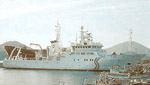 Onnuri |
| Survey Equipment | Survey Info | Data Type(s) | Data Collected |
|---|---|---|---|
| navigation | --- | Navigation | Integrated navigation (SINS) data o-1-97-cp.051 (Provisional best file) Best file with nav in ArcInfo E00 format |
| dredge | --- | Geology | o-1-97-cp.dredge5.pdf o-1-97-cp.dredge7.pdf o-1-97-cp.dredge8.pdf o-1-97-cp.dredge10.pdf o-1-97-cp.dredge13.pdf o-1-97-cp.dredge3-1.pdf o-1-97-cp.dredge14.pdf o-1-97-cp.dredges.toc.pdf o-1-97-cp.dredge12.pdf o-1-97-cp.dredge15.pdf o-1-97-cp.dredge1.pdf o-1-97-cp.dredge2.pdf o-1-97-cp.dredge3-2.pdf o-1-97-cp.dredge9.pdf Station log Station Information o-1-97-cp.dredge6.pdf o-1-97-cp.dredge4.pdf o-1-97-cp.dredge11.pdf |
