AKA: none
Other ID: P-01-13-LA
Status: Completed
Organization(s): USGS, Pacific Coastal and Marine Science Center
Funding Program(s): Global Distribution Geochemical Gas Hydrates (LQ000FP)
Principal Investigator(s): Patrick Hart
Affiliate Investigator(s): Seth Haines
Information Specialist(s): Patrick Hart
Data Type(s): Environmental Data: Turbidity, Imagery: Photo, Location-Elevation: Navigation, Seismics: Multichannel, Seismics: Sparker
Scientific Purpose/Goals: Investigate Gulf of America (Gulf of Mexico) gas hydrate deposits by acquiring high-resolution subbottom profiles and multicomponent seismic data
Vehicle(s):
Start Port/Location: Cocodrie, LA
End Port/Location: Cocodrie, LA
Start Date: 2013-04-15
End Date: 2013-05-13
Equipment Used: GPS, Multichannel, camera, sparker, OBS sensor, YoNav
Information to be Derived: High-resolution subbottom profiles and multicomponent seismic imaging of gas hydrate zones
Summary of Activity and Data Gathered:
Staff: Peter Dal Ferro, Patrick Hart, Ray Sliter, Jennifer White, Robert Wyland
Affiliate Staff:
Seth Haines
Tom O'Brien
Notes: Number of days at sea: 19 Project Maximum Weekly Overtime for Each: 44 Overtime Project Number: 12/13 GR12LQ000FP5800 Will Field Activity be at Least Seven Calendar Days With No Port Call (to calculate shore leave)? No Degree of Certainty: 100% Report Date: 2012-08-24 14:31:32
Staff information imported from InfoBank
Pat Hart
Seth Haines
Tom O'Brien
Eric Moore
Wayne Baldwin
Ray Sliter
Rob Wyland
Jenny White
Pete Dal Ferro
Non USGS data manager = Seth Haines
Location:
offshore Louisiana
| Boundaries | |||
|---|---|---|---|
| North: 29.25366 | South: 26.55896 | West: -91.7846 | East: -90.31713 |
Platform(s):
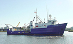 Pelican |
| Survey Equipment | Survey Info | Data Type(s) | Data Collected |
|---|---|---|---|
| GPS | --- | Navigation | Global positioning system (GPS) data p-01-13-la.063 (Provisional best file) Best file with nav in ArcInfo E00 format Integrated navigation (SINS) data p-01-13-la.050 Global positioning system (GPS) data p-01-13-la.062 (Provisional best file) |
| Multichannel | --- | Multichannel | Seismic FFID/Shot/CDP data p-01-13-la.410 (Provisional best file) |
| camera | --- | Photo | |
| sparker | --- | Sparker | |
| OBS sensor | --- | Turbidity | |
| YoNav | --- | Navigation |
