AKA: none
Other ID: P-05-12-CC
Status: Completed
Organization(s): Pacific Gas and Electric Company
Funding Program(s):
Data Source Information:
Information Specialist(s): Jonathan Childs
Data Type(s): Location-Elevation: Navigation, Seismics: Multichannel
Start Date: 2012-08-19
End Date: 2012-10-08
Equipment Used: navigation, Multichannel
Information to be Derived:
Summary of Activity and Data Gathered:
Notes: MCS Data transferred from PG&E to USGS for posting on NAMSS. Limited information available.
Location:
San Luis Bay
| Boundaries | |||
|---|---|---|---|
| North: 38.75 | South: 34.75 | West: -124.75 | East: -114.25 |
Platform(s):
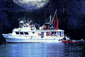 M/V Pacific Star |
| Survey Equipment | Survey Info | Data Type(s) | Data Collected |
|---|---|---|---|
| navigation | --- | Navigation | |
| Multichannel | --- | Multichannel |
