AKA: none
Other ID: P-1-02-SC
Status: Completed
Organization(s): University of California, Santa Barbara, Monterey Bay Aquarium Research Institute (MBARI), Grand Canyon Monitoring and Research Center, Moss Landing Marine Laboratories, USGS, Pacific Coastal and Marine Science Center
Funding Program(s): Natural Submarine Oil and Gas Seeps (MU198)
Principal Investigator(s): Thomas Lorenson
Affiliate Investigator(s): Charlie Paull
Information Specialist(s): Jennifer Dougherty
Data Type(s): Environmental Data: CTD, Location-Elevation: Navigation, Sampling: Chemistry, Seismics: Sub Bottom Profiler, Sonar: Single Beam
Scientific Purpose/Goals: This cruise will be dedicated to collecting hydrocasts over a section of the shelf adjacent to and north of Point Conception, CA. The intention is to better define the extent and location of natural hydrocarbon seeps. We will be measuring dissolved gases in the water column in real time.
Vehicle(s):
Start Port/Location: Moss Landing, CA
End Port/Location: Moss Landing, CA
Start Date: 2002-03-19
End Date: 2002-03-23
Equipment Used: 3.5khz, CTD, waterbottle, GPS, 12khz
Information to be Derived: Water chemistry
Summary of Activity and Data Gathered:
Staff: Jennifer Dougherty, Siddaharta Mitra
Affiliate Staff:
Charlie Paull (chief Scientist
MBARI) - Co
Bill Ussler (MBARI) - Scientist
Rendy Keaton (MBARI) - Scientist
Ira Leifer (UCSB) - Scientist
Kris Broederick (UCSB) - Scientist
Stewart Lamberdin (MLML) - Sr. Marine Technician
Doug Conlin (MLML) - Marine Technician
Steve Bliss (MLML) - Master
John Klusmire (MLML) - First Mate
Brad Martin (MLML) - Second Mate
Steve Wade (MLML) - Chief Engineer
Notes:
Staff information imported from InfoBank
Tom Lorenson (chief Scientist, USGS Western Region) - Co
Siddaharta Mitra (USGS Western Region) - Scientist
Jennifer Dougherty (USGS Western Region) - Scientist
Charlie Paull (chief Scientist, MBARI) - Co
Bill Ussler (MBARI) - Scientist
Rendy Keaton (MBARI) - Scientist
Ira Leifer (UCSB) - Scientist
Kris Broederick (UCSB) - Scientist
John Harris (University of Victoria) - Scientist
Stewart Lamberdin (MLML) - Sr. Marine Technician
Doug Conlin (MLML) - Marine Technician
Steve Bliss (MLML) - Master
John Klusmire (MLML) - First Mate
Brad Martin (MLML) - Second Mate
Steve Wade (MLML) - Chief Engineer
Location:
between Point Arguello and Point Conception
| Boundaries | |||
|---|---|---|---|
| North: 36.78822 | South: 34.07208 | West: -121.991 | East: -120.25778 |
Platform(s):
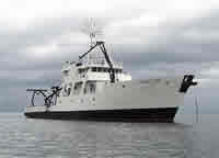
 Point Sur |
Lorenson, T.D., Hostettler, F.D., Rosenbauer, R.J., Peters, K.E., Kvenvolden, K.A., Dougherty, J.A., Gutmacher, C.E., Wong, F.L., and Normark, W.R., 2009, Natural offshore seepage and related tarball accumulation on the California coastline; Santa Barbara Channel and the southern Santa Maria Basin; source identification and inventory: U.S. Geological Survey Open-File Report 2009-1225, 116 p., http://pubs.usgs.gov/of/2009/1225/.
| Survey Equipment | Survey Info | Data Type(s) | Data Collected |
|---|---|---|---|
| 3.5khz | --- | Sub Bottom Profiler | Survey information |
| CTD | --- | Surveys (geochemical) Experiments (geochemical) CTD | Station Information |
| waterbottle | --- | Chemistry | Station Information |
| GPS | --- | Navigation | Global positioning system (GPS) data p-1-02-sc.062 (Provisional best file) Best file with nav in ArcInfo E00 format Global positioning system (GPS) data p-1-02-sc.060_raw Global positioning system (GPS) data p-1-02-sc.061_raw |
| 12khz | --- | Single Beam | Survey information |