AKA: none
Other ID: P-1-02-SF
Status: Completed
Organization(s): USGS, Pacific Coastal and Marine Science Center
Funding Program(s): San Francisco Bay Coastal System (ZP00DMA)
Principal Investigator(s): Francis Parchaso
Affiliate Investigator(s):
Information Specialist(s): Dan Allison
Data Type(s): Sampling: Geology, Location-Elevation: Navigation
Scientific Purpose/Goals: To acquire seasonal surface sediment samples to document changes in bed texture.
Vehicle(s):
Start Port/Location: MARFAC-Redwood City, CA
End Port/Location: MARFAC-Redwood City, CA
Start Date: 2002-01-22
End Date: 2002-01-23
Equipment Used: VanVeengrab, GPS
Information to be Derived: Grain size
Summary of Activity and Data Gathered: Collected samples from Boston Whaler at five stations. Collected samples from Polaris at seven stations.
Staff: Byron Richards, Scott Conrad, Dan Allison, Margaret Hampton, Irene Lavigne, Heather Peterson, Tara Schraga, Cary Lopez, Michelle Shouse, Noah Snyder, Cindy Brown
Affiliate Staff:
Rian Hoof (SFSU) - Unspecified
Notes: San Francisco Bay Seafloor and Sediment
Staff information imported from InfoBank
Byron Richards (USGS Western Region) - Captain
Scott Conrad (USGS Western Region) - Engineer
Francis Parchaso (USGS Western Region) - Chief Scientist
Dan Allison (USGS Western Region) - Unspecified
Margaret Hampton (USGS Western Region) - Unspecified
Rian Hoof (SFSU) - Unspecified
Irene Lavigne (USGS Western Region) - Unspecified
Heather Peterson (USGS Western Region) - Unspecified
Tara Schraga (USGS Western Region) - Unspecified
Cary Lopez (USGS Western Region) - Unspecified
Michelle Shouse (USGS Western Region) - Unspecified
Noah Snyder (USGS Western Region) - Unspecified
Cindy Brown (USGS Western Region) - Unspecified
Location:
San Francisco Bay
| Boundaries | |||
|---|---|---|---|
| North: 38.12887 | South: 38.03164 | West: -122.1398 | East: -121.93318 |
Platform(s):
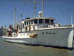 Polaris I |
Reid, J.A., Reid, J.M., Jenkins, C.J., Zimmermann, M., Williams, S.J., and Field, M.E., 2006, usSEABED: Pacific coast (California, Oregon, Washington) offshore surficial-sediment data release: U.S. Geological Survey Data Series 182, http://pubs.usgs.gov/ds/2006/182/.
| Survey Equipment | Survey Info | Data Type(s) | Data Collected |
|---|---|---|---|
| VanVeengrab | --- | Geology | Station Information |
| GPS | --- | Navigation | Best file with nav in ArcInfo E00 format Global positioning system (GPS) data p-1-02-sf.060 (Provisional best file) |
