AKA: none
Other ID: P-1-06-MB
Status: Completed
Organization(s): USGS, Pacific Coastal and Marine Science Center
Funding Program(s): National Seafloor Mapping and Benthic Habitat Studies (MU195)
Principal Investigator(s):
Affiliate Investigator(s):
Information Specialist(s): Gerry Hatcher
Data Type(s): Location-Elevation: Navigation, Sonar: Multibeam, Sonar: Sidescan
Scientific Purpose/Goals: re-map area surveyed in October 2005 to detect winter storm-induced change
Vehicle(s):
Start Port/Location: Santa Cruz small craft harbor
End Port/Location: Santa Cruz small craft harbor
Start Date: 2006-04-10
End Date: 2006-04-28
Equipment Used: navigation, multibeam, sidescansonar
Information to be Derived: water depth, acoustic backscatter, sound velocity
Summary of Activity and Data Gathered:
Staff: Michael Boyle, Gerry Hatcher, Andy Stevenson, Curt Storlazzi
Affiliate Staff:
Jared Figurski (UCSC) - vessel captain
Jamie Grover (UCSC) - vessel captain
Notes: UCSCs boat; Paragon files on /imgarc2/P-1-06-MB/ Associated field activities: P-1-05-MB W-1-05-MB F-1-06-MB F-2-06-MB F-3-06-MB P-1-06-MB P-P1-06-MB F-1-07-MB P-1-07-MB
Staff information imported from InfoBank
Curt Storlazzi (USGS) - chief scientist
Gerry Hatcher (USGS) - electronics technician
Mike Boyle (USGS) - electronics technician
Andy Stevenson (USGS) - geophysicist
Jared Figurski (UCSC) - vessel captain
Jamie Grover (UCSC) - vessel captain
Location:
northern Monterey Bay
| Boundaries | |||
|---|---|---|---|
| North: 37.50777 | South: 36.92944 | West: -122.21 | East: -121.94778 |
Platform(s):
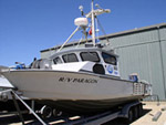 Paragon |
Storlazzi, C.D., Barnard, P.L., Collins, B.D., Finlayson, D.P., Golden, N.E., Hatcher, G.A., Kayen, R.E., and Ruggiero, P., 2007, High-resolution topographic, bathymetric, and oceanographic data for the Pleasure Point area, Santa Cruz County, California; 2005-2007: U.S. Geological Survey Open-File Report 2007-1270, 23 p., http://pubs.usgs.gov/of/2007/1270/.
| Survey Equipment | Survey Info | Data Type(s) | Data Collected |
|---|---|---|---|
| navigation | --- | Navigation | Best file with nav in ArcInfo E00 format Global positioning system (GPS) data p-1-06-mb.061 |
| multibeam | --- | Multibeam | File list |
| sidescansonar | --- | Sidescan |
