AKA: none
Other ID: P-13-85-AT
Status: Completed
Organization(s):
Funding Program(s):
Principal Investigator(s): Edward Escowitz
Affiliate Investigator(s): Andrew Grosz, Andrew E. Grosz
Information Specialist(s):
Data Type(s): Sampling: Geology, Sonar: Sidescan, Seismics: Sub Bottom Profiler
Scientific Purpose/Goals: Studied offshore areas
Vehicle(s):
Start Port/Location: Lauderdale, FL
End Port/Location: Washington, D.C.
Start Date: 1985-06-03
End Date: 1985-06-28
Equipment Used: vibratingcore, grab, sidescansonar, seismic
Information to be Derived:
Summary of Activity and Data Gathered: 60 vibracores, 72 grab samples, 7 km IP data, high-resolution seismic reflection profiling, side-scan sonar profiling
Staff: Larry Kooker, Mark Brown, Jeff Abbey, Cecil Ray, Jack Swenson, Hal Williams, Roy Fields
Affiliate Staff:
Ricardo Lopez - Unspecified
John Winningham - Unspecified
William Parsons - Unspecified
Brian Wehmeyer - Unspecified
Kelley Murray - Unspecified
Roland Jones - Unspecified
Dennis Gaffney - Unspecified
Albert Merlino - Unspecified
Eric Tillman - Unspecified
Christopher Galagan - Unspecified
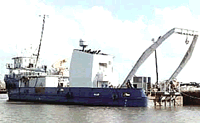
Notes: First time Powell was used for seafloor sampling. Test of underwater induced polarization (IP) streamer developed by Jeff Wynn, USGS, Reston.
Staff information imported from InfoBank
Edward Escowitz (USGS Eastern Region) - Chief Scientist
Andrew Grosz - Chief Scientist
Larry Kooker (USGS Western Region) - Unspecified
Ricardo Lopez - Unspecified
Mark Brown - Unspecified
John Winningham - Unspecified
Jeff Abbey - Unspecified
Cecil Ray - Unspecified
William Parsons - Unspecified
Brian Wehmeyer - Unspecified
Kelley Murray - Unspecified
Roland Jones - Unspecified
Dennis Gaffney - Unspecified
Albert Merlino - Unspecified
Eric Tillman - Unspecified
Jack Swenson - Unspecified
Hal Williams (USGS Western Region) - Unspecified
Roy Fields - Unspecified
Christopher Galagan - Unspecified
Location:
North Carolina and Virginia offshore
| Boundaries | |||
|---|---|---|---|
| North: 66.75 | South: -59.75 | West: -99.75 | East: 19.75 |
Platform(s):
 John Wesley Powell |
| Survey Equipment | Survey Info | Data Type(s) | Data Collected |
|---|---|---|---|
| vibratingcore | --- | Geology | |
| grab | --- | Geology | |
| sidescansonar | --- | Sidescan | |
| seismic | --- | Sub Bottom Profiler |