AKA: none
Other ID: P-1-66-WO
Status: Completed
Organization(s): USGS, Pacific Coastal and Marine Science Center
Funding Program(s):
Principal Investigator(s): Gene Rusnak
Affiliate Investigator(s):
Information Specialist(s):
Data Type(s): Electro-Magnetic: Magnetics, Location-Elevation: Navigation, Sampling: Geology, Seismics: Air Gun / Water Gun, Seismics: Sparker, Sonar: Single Beam
Scientific Purpose/Goals: PURPOSE: A. Collect geological information on types and sources of sediment deposited on the inshore continental shelf off Oregon in connection with the exploration for heavy metals. B. Obtain sparker and airgun sub-bottom profiles in selected areas. C. Obtain grab samples from selected stations. D. Collect bathymetric data in areas of interest.
Vehicle(s):
Start Port/Location: Redwood City, CA and Ft. Bragg, CA and Newport, OR and Newport, OR and Astoria, OR and Newport, OR and Coos Bay, OR and Charleston, OR and Charleston, OR and Charleston, OR and Charleston, OR and Port Orford, OR
End Port/Location: Ft. Bragg, CA and Newport, OR and Newport, OR and Astoria, OR and Newport, OR and Coos Bay, OR and Charleston, OR and Charleston, OR and Charleston, OR and Charleston, OR and Port Orford, OR and Redwood City, CA
Start Date: 1966-08-22
End Date: 1966-09-28
Equipment Used: airgun, bathymetry, Shipekgrab, magnetics, radar, sparker
Information to be Derived: Seismic reflection profiles, bathymetry.
Summary of Activity and Data Gathered: physical data holdings Summary Sparker tracks were run using two electrode cages, arcing in unison, and separated by a distance of 30 feet. Small depressers attached to the cages were, in the course of the cruise, added to keep the electrodes in the water (approximately 15 feet) at higher speeds (up to 10k). The sparker tracks were conducted at varying speeds throughout the cruise depending on the nature of the bottom and the performance of equipment. A total of 92 samples were obtained with a shipek grab sampler in the course of this cruise. Bathymetric records were made concurrent with all sparker tracks. The magnetometer proved unreliable on all tests and its use was subsequently discontinued. Position fixes were obtained primarily with the Decca, Model TM629, radar. About 1800 nautical miles were covered in the course of the cruise.
Staff: C. Winegard
Affiliate Staff:
Jerry Joslin (Polaris) - Captain
R. Stacey (Polaris) - Captain
E. Magalhaes (Polaris) - Engineer
B. Ladd (Polaris) - Electronic Technician
P. Lyons (Polaris) - Electonic Technician
W. Black (Polaris) - Crew
W. Glen (Polaris) - Cook
Notes: Staff information imported from InfoBank
Gene Rusnak (USGS Western Region) - Chief Scientist
Jerry Joslin (Polaris) - Captain
R. Stacey (Polaris) - Captain
E. Magalhaes (Polaris) - Engineer
B. Ladd (Polaris) - Electronic Technician
C. Winegard (USGS Western Region) - Geologist
P. Lyons (Polaris) - Electonic Technician
W. Black (Polaris) - Crew
W. Glen (Polaris) - Cook
Location:
Inshore Continental Shelf Off Oregon
| Boundaries | |||
|---|---|---|---|
| North: 50 | South: 41 | West: -131.25 | East: -122.25 |
Platform(s):
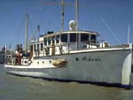 Polaris I |
Clifton, H.E., 1968, Gold distribution in surface sediments on the continental shelf off southern Oregon: A preliminary report: Circular 587, 8 p.
| Survey Equipment | Survey Info | Data Type(s) | Data Collected |
|---|---|---|---|
| airgun | --- | Air Gun / Water Gun | |
| bathymetry | --- | Single Beam | |
| Shipekgrab | --- | Geology | |
| magnetics | --- | Magnetics | |
| radar | --- | Navigation | |
| sparker | --- | Sparker |
