AKA: none
Other ID: P-1-72-WF
Status: Completed
Organization(s):
Funding Program(s):
Principal Investigator(s): Parke Snavely
Affiliate Investigator(s):
Information Specialist(s):
Data Type(s): Electro-Magnetic: Gravity, Electro-Magnetic: Magnetics, Location-Elevation: Navigation, Seismics: Boomer, Sonar: Single Beam
Scientific Purpose/Goals:
Vehicle(s):
Start Port/Location:
End Port/Location:
Start Date: 1972-05-23
End Date: 1972-06-02
Equipment Used: bathymetry, gravity, magnetics, navigation, uniboom
Information to be Derived:
Summary of Activity and Data Gathered:
Staff:
Affiliate Staff:
Notes:
Staff information imported from InfoBank
Parke Snavely (USGS Western Region) - Chief Scientist
Location:
Juan de Fuca
| Boundaries | |||
|---|---|---|---|
| North: 48.6879 | South: 47.7327 | West: -125.1515 | East: -122.4496 |
Platform(s):
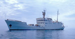 Parizeau |
Snavely, P.D., and Tiffin, D.L., 1980, Seismic reflection profiles from cooperative investigations in the Strait of Juan de Fuca by the U.S. Geological Survey and Geological Survey of Canada aboard the Canadian survey ship Parizeau, between May 15 and June 3, 1972: U.S. Geological Survey Open-File Report 80-239, http://ngmdb.usgs.gov/Prodesc/proddesc_11563.htm.
Snavely, P.D.J., Tiffin, D.L., MacLeod, N.S., and Currie, R.G., 1974, Preliminary gravity and magnetic maps of the Strait of Juan de Fuca, British Columbia, Canada, and Washington, United States: U.S. Geological Survey Open-File Report 74-5096, 10 p.
Steele, W.C., Degnan, C.H., Deeter, G.B., and Riordan, J.A., 1989, Description of marine geophysical data collected by the U.S. Geological Survey and how to obtain it: U.S. Geological Survey Open-File Report 89-167, 26 p., https://pubs.er.usgs.gov/publication/ofr89167.
Wagner, H.C., and Wiley, M.C., 1980, Preliminary map of offshore geology in the Protection Island-Point Partridge area, northern Puget Sound, Washington: U.S. Geological Survey Open-File Report 80-548, http://pubs.usgs.gov/of/1980/0548/report.pdf.
| Survey Equipment | Survey Info | Data Type(s) | Data Collected |
|---|---|---|---|
| bathymetry | --- | Single Beam | Raw depth (bathymetry) data p-1-72-wf.300 Raw depth (bathymetry) data p-1-72-wf.300_051 (Provisional best file) NGDC MGD77 data - bathy |
| gravity | --- | Gravity | Free Air Anomaly data p-1-72-wf.160 Free Air Anomaly data p-1-72-wf.160_051 (Provisional best file) NGDC MGD77 data - gravity |
| magnetics | --- | Magnetics | Raw gradiometer data p-1-72-wf.240 Raw gradiometer data p-1-72-wf.240_051 Edited gradiometer data p-1-72-wf.260_051 (Provisional best file) NGDC MGD77 data - Magnetics |
| navigation | --- | Navigation | Best file with nav in ArcInfo E00 format Integrated navigation (SINS) data p-1-72-wf.051 (Provisional best file) Integrated navigation (SINS) data p-1-72-wf.051_degree |
| uniboom | --- | Boomer |
