AKA: none
Other ID: P-1-89-AR
Status: Completed
Organization(s):
Funding Program(s):
Principal Investigator(s): Art Grantz
Affiliate Investigator(s):
Information Specialist(s):
Data Type(s): Location-Elevation: Navigation, Sampling: Geology
Scientific Purpose/Goals:
Vehicle(s):
Start Port/Location:
End Port/Location:
Start Date: 1989-08-17
End Date: 1989-08-26
Equipment Used: navigation, boxcore, gravitycore, pistoncore
Information to be Derived:
Summary of Activity and Data Gathered:
Staff:
Affiliate Staff:
Notes: Physical data holdings
Please note piston core locations were in error (8/21/2013); Samp KMZ now displays correct locations listed in OFR 91-34 (.pdfs listed above in scanned materials). NOTE: piston core #5 plots below #2; location on .pdf states 142 degrees (either error in lon. location or plot)
Staff information imported from InfoBank
Art Grantz (USGS Western Region) - Chief Scientist
Location:
Arctic
| Boundaries | |||
|---|---|---|---|
| North: 71.81455 | South: 70.2886 | West: -144.13 | East: -140.45772 |
Platform(s):
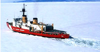 Polar Star |
Phillips, R.L., Grantz, A., Mullen, M.W., and White, J.M., 1991, Preliminary Lithostratigraphy of Piston cores from the Beaufort Sea Continental Slope off Northeastern Alaska: U.S. Geological Survey Open-File Report 91-34, 2 p., https://pubs.er.usgs.gov/publication/ofr9134.
| Survey Equipment | Survey Info | Data Type(s) | Data Collected |
|---|---|---|---|
| navigation | --- | Navigation | Global positioning system (GPS) data p-1-89-ar.063_degree Best file with nav in ArcInfo E00 format Global positioning system (GPS) data p-1-89-ar.063 (Provisional best file) Satellite data p-1-89-ar.000 Satellite data p-1-89-ar.005 Global positioning system (GPS) data p-1-89-ar.061 |
| boxcore | --- | Biology Geology | Station Information |
| gravitycore | --- | Geology | Station Information |
| pistoncore | --- | Geology | Station Information |
