AKA: none
Other ID: P-1-93-AR
Status: Completed
Organization(s):
Funding Program(s):
Principal Investigator(s): Art Grantz
Affiliate Investigator(s):
Information Specialist(s):
Data Type(s): Electro-Magnetic: Gravity, Electro-Magnetic: Magnetics, Environmental Data: CTD, Location-Elevation: Navigation, Sampling: Biology, Sampling: Geology, Seismics: Air Gun / Water Gun, Seismics: Multichannel, Seismics: Sonobuoy, Sonar: Single Beam
Scientific Purpose/Goals:
Vehicle(s):
Start Port/Location:
End Port/Location:
Start Date: 1993-08-17
End Date: 1993-09-15
Equipment Used: CTD, Other, multichannel, gravity, magnetics, boxcore, navigation, bathymetry, pistoncore, sonobuoy, airgun
Information to be Derived:
Summary of Activity and Data Gathered:
Staff: Jonathan Childs, Dave Dinter, Ledabeth Gray, Patrick Hart, Michael McCormick, Mark McLaughlin, Mike Mullen, Kevin O'Toole, Bill Robinson, David Scholl, Jim Vaughan, Hal Williams
Affiliate Staff:
Larry Phillips (USGS Western Region) - Geologist
H. Ruth Jackson (Geological Survey of Canada) - Geophysicist
Carl Byers (Fairbanks) - University of Alaska
Shusun Li (Fairbanks) - University of Alaska
Kenneth Schwartz (Fairbanks) - University of Alaska
Alan Gagnon - Woods Hole Oceanographic Institution
Notes: physical data holdings
seismic equipment type added 2/14/18
Staff information imported from InfoBank
Art Grantz (USGS Western Region) - Chief Scientist
Jon Childs (USGS Western Region) - Geophysicist
Dave Dinter (USGS Western Region) - Geophysicist
Ledabeth Gray (USGS Western Region) - Navigator
Pat Hart (USGS Western Region) - Geophysicist
Michael McCormick (USGS Western Region) - Geologist
Mark McLaughlin (USGS Western Region) - Geologist
Mike Mullen (USGS Western Region) - Geologist
Kevin O'Toole (USGS Western Region) - Mechanical Technician
Larry Phillips (USGS Western Region) - Geologist
Bill Robinson (USGS Western Region) - Electronic Technician
Dave Scholl (USGS Western Region) - Geologist
Jim Vaughn (USGS Western Region) - Electronic Technician
Hal Williams (USGS Western Region) - Mechanical Technician
H. Ruth Jackson (Geological Survey of Canada) - Geophysicist
Carl Byers (Fairbanks) - University of Alaska
Shusun Li (Fairbanks) - University of Alaska
Kenneth Schwartz (Fairbanks) - University of Alaska
Alan Gagnon - Woods Hole Oceanographic Institution
Location:
Northwind Escarpment
| Boundaries | |||
|---|---|---|---|
| North: 78.80412 | South: 70.98872 | West: -159.673 | East: -137.59459 |
Platform(s):
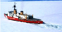 Polar Star |
Grantz, A., Hart, P.E., Phillips, R.L., McCormick, M., Perkin, R.G., Jackson, R., Gagnon, A., Li, S., Byers, C., and Schwartz, K.R., 1993, Cruise report and preliminary results, U.S. Geological Survey Cruise P1-93-AR, Northwind Ridge and Canada Basin, Arctic Ocean, aboard USCGC Polar Star, August 16-September 15, 1993: U.S. Geological Survey Open-File Report 93-0389, 35 p., https://pubs.er.usgs.gov/publication/ofr93389.
Grantz, A., May, Steven D., Hart, Patrick E., and Srivastava, S.P., 1995, Crustal structure of the Canada Basin, Arctic Ocean, and the character of the continental margin north of Alaska: American Geophysical Union Eos, Transactions, v. 76 no. 46, pp. 592–593.
Hart, P.E., Grantz, Arthur, May, Steven D., O'Toole, Kevin, and Erickson, Jon, 1995, Seismic profiling through the Arctic Ocean ice pack: American Geophysical Union Eos, Transactions, v. 76 no. 46, pp. 589–589.
