AKA: none
Other ID: P-1-93-SF
Status: Completed
Organization(s):
Funding Program(s):
Principal Investigator(s): Paul Carlson, Gary Mann, Mike Marlow
Affiliate Investigator(s):
Information Specialist(s):
Data Type(s): Location-Elevation: Navigation, Seismics: Boomer, Seismics: Sub Bottom Profiler, Sonar: Sidescan
Scientific Purpose/Goals: Japanese sonar data collection using differential GPS as navigation
Vehicle(s):
Start Port/Location:
End Port/Location:
Start Date: 1993-09-20
End Date: 1993-09-23
Equipment Used: GPS, mudseis, Geopulse, subbottomprofiler, sidescansonar
Information to be Derived:
Summary of Activity and Data Gathered:
Staff: Dave Hogg, Larry Kooker, Dennis Mann, Byron Richards
Affiliate Staff:
Notes: Mike Marlow has taken the MudSeis opticals to Dennis Mann.
Staff information imported from InfoBank
Dennis Mann (USGS Western Region) - Geophysicist
Gary Mann (USGS Western Region) - Chief Scientist
Mike Marlow (USGS Western Region) - Chief Scientist
Paul Carlson (USGS Western Region) - Chief Scientist
Larry Kooker (USGS Western Region) - Electronic Technician
Dave Hogg (USGS Western Region) - Electronic Technician
Byron Richards (Polaris) - Captain
Location:
California
| Boundaries | |||
|---|---|---|---|
| North: 37.91425 | South: 37.50879 | West: -122.4943 | East: -122.19286 |
Platform(s):
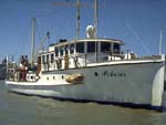 Polaris I |
Marlow, M.S., Hart, P.E., Carlson, P.R., Childs, J.R., Mann, D.M., Anima, R.J., and Kayen, R.E., 1994, High-resolution seismic-reflection profiles and interpretation pitfalls created by acoustic anomalies from Holocene muds beneath South San Francisco Bay: U.S. Geological Survey Open-File Report 94-0639, 16 p.
| Survey Equipment | Survey Info | Data Type(s) | Data Collected |
|---|---|---|---|
| GPS | --- | Navigation | Integrated navigation (SINS) data p-1-93-sf.050 (Provisional best file) Integrated navigation (SINS) data p-1-93-sf.050_degree Eotvos/course/speed/distance data p-1-93-sf.070 Best file with nav in ArcInfo E00 format |
| mudseis | --- | Sub Bottom Profiler | |
| Geopulse | --- | Boomer | chirp (data on FAD) |
| subbottomprofiler | --- | Sub Bottom Profiler | |
| sidescansonar | --- | Sidescan |
