AKA: none
Other ID: P-1-94-MB
Status: Completed
Organization(s):
Funding Program(s):
Principal Investigator(s): Dave Cacchione
Affiliate Investigator(s):
Information Specialist(s):
Data Type(s): Time Series: Mooring (physical oceanography), Imagery: Photo
Scientific Purpose/Goals: Geoprobe and video Soquel Canyon
Vehicle(s):
Start Port/Location:
End Port/Location:
Start Date: 1994-06-01
End Date: 1994-06-30
Equipment Used: Geoprobe, underwatercamera
Information to be Derived:
Summary of Activity and Data Gathered:
Staff:
Affiliate Staff:
Notes:
Staff information imported from InfoBank
Dave Cacchione (USGS Western Region) - Chief Scientist
Location:
Soquel Canyon
| Boundaries | |||
|---|---|---|---|
| North: 37.25 | South: 36.5 | West: -122.75 | East: -121.75 |
Platform(s):
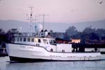 Point Lobos |
| Survey Equipment | Survey Info | Data Type(s) | Data Collected |
|---|---|---|---|
| Geoprobe | --- | Mooring (physical oceanography) | |
| underwatercamera | --- | Video Photo |
