AKA: none
Other ID: P-2-70-SC,PT. HUNEME
Status: Completed
Organization(s): USGS, Pacific Coastal and Marine Science Center
Funding Program(s):
Principal Investigator(s): Gary Greene
Affiliate Investigator(s):
Information Specialist(s):
Data Type(s): Electro-Magnetic: Magnetics, Location-Elevation: Navigation, Seismics: Boomer, Seismics: Sparker
Scientific Purpose/Goals:
Vehicle(s):
Start Port/Location: Pt. Heuneme, CA and Marina Del Rey, CA and San Pedro, CA and Newport Beach, CA and Oceanside, CA and Oceanside, CA and Oceanside, CA and Newport Beach, CA and San Pedro, CA
End Port/Location: Marina Del Rey, CA and San Pedro, CA and Newport Beach, CA and Oceanside, CA and Oceanside, CA and Oceanside, CA and Newport Beach, CA and San Pedro, CA and Marina Del Rey, CA
Start Date: 1970-11-20
End Date: 1970-12-05
Equipment Used: uniboom, minisparker, sparker, magnetics, deadreckoning
Information to be Derived: Seismic reflection profiles, bathymetry, magnetics.
Summary of Activity and Data Gathered: 44 lines were run from Pt. Hueneme to Pt. La Jolla for high resolution seismic profiling, bathymetry, sparker, and magnetics. Offshore Navigation Inc. made sonobuoy runs.
Staff: Joe Bauer, Ken Blom, Frank Lewis, George Moore, Bill Olander, Bob Patrick
Affiliate Staff:
Steve Wolfe - USGS
Jerry Joslin
Jim Tomkins (Inc.) - Offshore Navigation
John Watkins (Inc.) - Offshore Navigation
Notes: Staff information imported from InfoBank
George Moore - USGS
Steve Wolfe - USGS
Robert Patrick - USGS
Ken Blom - USGS
Jerry Joslin
Frank Lewis
Bill Olander
Joe Bauer
Jim Tomkins (Inc.) - Offshore Navigation
John Watkins (Inc.) - Offshore Navigation
Location:
Southern California
| Boundaries | |||
|---|---|---|---|
| North: 34.12116 | South: 32.83755 | West: -119.207 | East: -117.27068 |
Platform(s):
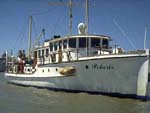 Polaris I |
Moore, G.W., 1975, Acoustic reflection profiles R/V Polaris, Nov.-Dec. 1970, Offshore Southern California Port Hueneme to Point La Jolla: U.S. Geological Survey Open-File Report 75-629.
