AKA: none
Other ID: P-2-79-SC
Status: Completed
Organization(s): U.S. Army Coastal Engineering Research Center, Woodward-Clyde Consultants
Funding Program(s):
Principal Investigator(s):
Affiliate Investigator(s): Jan Rietman (Woodward, Clyde Consultants)
Information Specialist(s):
Data Type(s): Location-Elevation: Navigation, Sonar: Single Beam, Sonar: Sidescan, Seismics: Sub Bottom Profiler, Seismics: Boomer
Scientific Purpose/Goals: To collect 300 nautical miles of seismic reflection and side scan sonar data at selected locations along the Southern California coast for the U.S. Army Coastal Engineering Research Center for the purpose of selecting tentative core locations and correlating seismic data with cores when collected to delineate sand resources.
Vehicle(s):
Start Port/Location: San Diego, CA and Mission Bay, CA and La Jolla, CA and Oceanside Harbor, CA
End Port/Location: San Diego, CA and San Diego, CA and Mission Bay, CA and La Jolla, CA and Oceanside Harbor, CA
Start Date: 1979-10-15
End Date: 1979-11-06
Equipment Used: rangerange, bathymetry, Kleinsidescan, 3.5khz, uniboom
Information to be Derived:
Summary of Activity and Data Gathered: A total of 300 nautical miles of surveying were proposed for four areas (offshore Oceanside, La Jolla, Mission Beach, and San Diego) and the interconnecting lines. The survey area extended offshore from the seaward limit of breaking waves to a water depth of about 250 ft. The actual shoreline limit of survey lines varied between water depths of 20 to 30 ft depending on weather and shoreline conditions. Where kelp beds prevented survey operations, it was necessary to alter or eliminate some of the proposed survey lines. The kelp bed areas were not considered as viable locations of offshore sand resources because kelp beds require an exposed bedrock or cobble bottom with only sparce sand overburden. The survey plan included simultaneous data collection from the following systems along each line of the survey: navigation system with track plotter, fathometer, side scan sonar, tuned transducer, and high resolution subbottom profiler.
Staff:
Affiliate Staff:
Robert Beer (Woodward
Clyde Consultants) - Geophysicist
Robert Burke (Woodward
Clyde Consultants) - Electronics Engineer
Joseph Resta (Woodward
Clyde Consultants) - Geophysicist
Notes: Woodward-Clyde Consultants contract
Staff information imported from InfoBank
Jan Rietman (Woodward, Clyde Consultants) - Chief Scientist
Robert Beer (Woodward, Clyde Consultants) - Geophysicist
Robert Burke (Woodward, Clyde Consultants) - Electronics Engineer
Joseph Resta (Woodward, Clyde Consultants) - Geophysicist
Location:
Southern California
| Boundaries | |||
|---|---|---|---|
| North: 34.75 | South: 32.25 | West: -122.75 | East: -116.75 |
Platform(s):
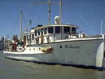 Polaris I |
| Survey Equipment | Survey Info | Data Type(s) | Data Collected |
|---|---|---|---|
| rangerange | --- | Navigation | |
| bathymetry | --- | Single Beam | |
| Kleinsidescan | --- | Sidescan | |
| 3.5khz | --- | Sub Bottom Profiler | |
| uniboom | --- | Boomer |
