AKA: none
Other ID: P-3-07-MB
Status: Completed
Organization(s): USGS, Pacific Coastal and Marine Science Center
Funding Program(s): California Urban Ocean (MU034)
Principal Investigator(s): Bill Normark, Charles Paull
Affiliate Investigator(s): Charlie Paull
Information Specialist(s): Bill Normark
Data Type(s): Location-Elevation: Navigation, Sampling: Geology
Scientific Purpose/Goals: The primary goal was to acquire an approximately 130-meter long transect of cores across the sediment waves in the Monterey Canyon floor at water depths of approximately 285 meters. Processing and analysis of these cores will be used to study the origin of the sediment waves.
Vehicle(s):
Start Port/Location: Moss Landing
End Port/Location: Moss Landing
Start Date: 2007-10-15
End Date: 2007-10-22
Equipment Used: GPS, core
Information to be Derived: Late Holocene history of sediment transport through the upper (~285 m water depth) Monterey Canyon
Summary of Activity and Data Gathered: Will come later after cruise is completed
Staff:
Affiliate Staff:
Notes: Submarine Canyon Transport Processes. Bill Normark and Stanford graduate students. No impact on WCMG Full project name: Submarine Canyon Transport Processes and history of activity (under Turbidity currents Task of Urban Ocean) Associated field activities: P-2-07-MB
Location:
Monterey Bay Sanctuary area
| Boundaries | |||
|---|---|---|---|
| North: 36.80267 | South: 36.77864 | West: -121.903 | East: -121.80256 |
Platform(s):
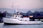 Point Lobos |
| Survey Equipment | Survey Info | Data Type(s) | Data Collected |
|---|---|---|---|
| GPS | --- | Navigation | Best file with nav in ArcInfo E00 format Global positioning system (GPS) data p-3-07-mb.060 (Provisional best file) |
| core | --- | Biology Geology | Station Information |
