AKA: none
Other ID: P-5-00-MB
Status: Completed
Organization(s): Monterey Bay Aquarium Research Institute (MBARI)
Funding Program(s):
Principal Investigator(s): Charles Paull
Affiliate Investigator(s): Charlie Paull
Information Specialist(s): Charles Paull
Data Type(s): Location-Elevation: Navigation, Sampling: Geology
Scientific Purpose/Goals:
Vehicle(s):
Start Port/Location:
End Port/Location:
Start Date: 2000-11-17
End Date: 2000-11-21
Equipment Used: GPS, vibratingcore
Information to be Derived:
Summary of Activity and Data Gathered:
Staff:
Affiliate Staff:
Notes: Non USGS data manager = Charlie Paull
Location:
CA
| Boundaries | |||
|---|---|---|---|
| North: 36.79397 | South: 36.76075 | West: -122.04 | East: -121.84579 |
Platform(s):
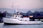 Point Lobos |
| Survey Equipment | Survey Info | Data Type(s) | Data Collected |
|---|---|---|---|
| GPS | --- | Navigation | Best file with nav in ArcInfo E00 format Global positioning system (GPS) data p-5-00-mb.060 (Provisional best file) |
| vibratingcore | --- | Geology | V1869_VC-18_0-83cm.jpg V1870_VC-19_90-180cm.jpg V1870_VC-19_0-90cm.jpg V1871_VC-20_0-90cm.jpg V1871_VC-20_90-120cm.jpg V1872_VC-21_0-45cm.jpg V1873_VC-22_0-92cm.jpg V1874_VC-23_0-65cm.jpg V1875_VC-24_0-45cm.jpg V1877_VC-27_0-90cm.jpg Station Information V1877_VC-27_90-150cm.jpg V1878_VC-28_0-65cm.jpg V1876_VC-26_0-90cm.jpg V1876_VC-26_90-125cm.jpg |
