AKA: none
Other ID: P-5-70-SF
Status: Completed
Organization(s): USGS, Pacific Coastal and Marine Science Center
Funding Program(s):
Principal Investigator(s): Dave McCulloch
Affiliate Investigator(s):
Information Specialist(s):
Data Type(s): Sonar: Single Beam, Seismics: Boomer
Scientific Purpose/Goals: Boomer and bathymetry profiles between Alamea and India Basin.
Vehicle(s):
Start Port/Location: Redwood City, CA
End Port/Location: Redwood City, CA
Start Date: 1970-02-09
End Date: 1970-02-09
Equipment Used: bathymetry, boomer
Information to be Derived: Bathymetry and subsurface structure.
Summary of Activity and Data Gathered: Fathometer and boomer runs between Alameda and India Basin.
Staff:
Affiliate Staff:
Notes: Information derived from fathometer and boomer rolls.
Staff information imported from InfoBank
Dave McCulloch (USGS Western Region) - Chief Scientist
Location:
CA
| Boundaries | |||
|---|---|---|---|
| North: 38.25 | South: 37.25 | West: -123.25 | East: -121.25 |
Platform(s):
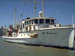 Polaris I |
| Survey Equipment | Survey Info | Data Type(s) | Data Collected |
|---|---|---|---|
| bathymetry | --- | Single Beam | |
| boomer | --- | Boomer |
