AKA: none
Other ID: P-5-87-MB
Status: Completed
Organization(s):
Funding Program(s):
Principal Investigator(s):
Affiliate Investigator(s):
Information Specialist(s):
Data Type(s): Sonar: Single Beam
Scientific Purpose/Goals:
Vehicle(s):
Start Port/Location:
End Port/Location:
Start Date: 1987-01-01
End Date: 1987-01-01
Equipment Used: bathymetry
Information to be Derived:
Summary of Activity and Data Gathered:
Staff:
Affiliate Staff:
Notes: physical data holdings
Location:
California
| Boundaries | |||
|---|---|---|---|
| North: 37.25 | South: 36.5 | West: -122.75 | East: -121.75 |
Platform(s):
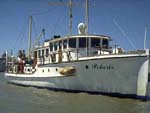 Polaris I |
| Survey Equipment | Survey Info | Data Type(s) | Data Collected |
|---|---|---|---|
| bathymetry | --- | Single Beam |
