AKA: none
Other ID: P-7-94-AN,NBP94-7
Status: Completed
Organization(s): USGS, Pacific Coastal and Marine Science Center
Funding Program(s): Ross Sea Acoustic Stratigraphy (MU241)
Principal Investigator(s): Guy Cochrane
Affiliate Investigator(s):
Information Specialist(s):
Data Type(s): Seismics: Sonobuoy
Scientific Purpose/Goals: To collect 10 meter resolution seismic data and piston cores in the Paleogene and Neogene section in the Eastern Basin to improve our understanding of the relationship between the timing of the Antarctic Cenozoic glacial, glacio-eustatic, and global climatic events.
Vehicle(s):
Start Port/Location:
End Port/Location:
Start Date: 1994-12-27
End Date: 1995-02-05
Equipment Used: sonobuoy
Information to be Derived:
Summary of Activity and Data Gathered: Collected 46 refraction records at 27 sites on the Ross Sea continental shelf of Antarctica
Staff:
Affiliate Staff:
Notes: (from USGS Bulletin, 1/20/95) A multi-institutional group. Guy is collecting sonobuoy seimic- refraction data in conjunction with the high-resolution reflection data collection in order to help identify areas of outcropping older sediment and improve his models of ice-loading related sediment over consolidation. The sonobuoys displayed a 50% failure rate but are deployed two at a time successfully.
Staff information imported from InfoBank
Guy Cochrane (USGS Western Region) - Chief Scientist
Location:
Antarctica
| Boundaries | |||
|---|---|---|---|
| North: -10.25 | South: -89.75 | West: 165.25 | East: -149.75 |
Platform(s):
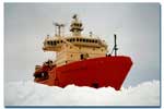 Nathaniel B Palmer |
| Survey Equipment | Survey Info | Data Type(s) | Data Collected |
|---|---|---|---|
| sonobuoy | --- | Sonobuoy |
