AKA: none
Other ID: R-1-81-NC
Status: Completed
Organization(s): USGS, Pacific Coastal and Marine Science Center
Funding Program(s): Climate (MU046)
Principal Investigator(s): Jim Gardner
Affiliate Investigator(s):
Information Specialist(s):
Data Type(s): Sampling: Geology, Sampling: Chemistry
Scientific Purpose/Goals: Sediment and water sampling.
Vehicle(s):
Start Port/Location: Garcia River, CA
End Port/Location: Mad River, CA
Start Date: 1981-07-06
End Date: 1981-07-10
Equipment Used: VanVeengrab, VanDornbottle
Information to be Derived:
Summary of Activity and Data Gathered: Garcia River sampled one mile upstream from mouth. Navarro River sampled 1 mile upstream from mouth - 3 samples and mid-river water sample. Big River sampled 1 mile upstream from mouth - 3 samples and mid-river water sample. Noyo River sampled 1 mile upstream from mouth - 2 samples and mid-river water sample. Ten Mile River sampled near freeway bridge - 1 outcrop sample, 1 bottom sample, and 1 water sample. Mattole River sampled 1.5 miles upstream from mouth - 3 samples and water sample at south bank. Centerville Beach geologic observations. Eel River sampled above bridge at Fernbridge - 2 samples and mid-river water sample. Mad River sampled 1 mile from mouth - 3 samples and mid-river water sample. Redwood Creek sampled 2.5 miles from mouth - sample W of 101 Bridge and mid-stream water sample. Klamath River sampled 2.75 miles from mouth - 2 bags from south shore station and mid-river water sample. Smith River sampled upstream from mouth - 2 samples (N and S shores) and water sample from shore.
Staff: Dave Klise, Bob Hall
Affiliate Staff:
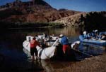
Notes: Inflatible raft and canoe were used.
Staff information imported from InfoBank
Jim Gardner (USGS Western Region) - Chief Scientist
Dave Klise (USGS Western Region) - Scientist
Bob Hall (USGS Western Region) - Scientist
Location:
CA
| Boundaries | |||
|---|---|---|---|
| North: 41.75 | South: 37.75 | West: -125.75 | East: -122.25 |
Platform(s):
 Raft |
Wong, F.L. and K., D.H., 1986, Heavy mineral, clay mineral, and geochemical data of surface sediments from coastal northern California rivers: U.S. Geological Survey Open-File Report 86-57.
| Survey Equipment | Survey Info | Data Type(s) | Data Collected |
|---|---|---|---|
| VanVeengrab | --- | Geology | |
| VanDornbottle | --- | Chemistry |