AKA: none
Other ID: R-1-99-GC,R1-99-GC
Status: Completed
Organization(s):
Funding Program(s):
Principal Investigator(s): Roberto Anima
Affiliate Investigator(s):
Information Specialist(s): Michael Hamer
Data Type(s): Location-Elevation: Navigation, Sonar: Sidescan, Sonar: Single Beam
Scientific Purpose/Goals:
Vehicle(s):
Start Port/Location:
End Port/Location:
Start Date: 1999-05-26
End Date: 1999-06-05
Equipment Used: Kleinsidescan, GPS, bathymetry
Information to be Derived:
Summary of Activity and Data Gathered:
Staff: Steve Bledsoe, Bob Bohannon, Ingrid Corson, Brian Dierker, Michael Hamer, Dave Hogg, Carol Reiss
Affiliate Staff:
Paul Kinzel (Sediment Raft
USGS Central Region WRD) - Sediment Sampling
Keith Kohl (Sediment Raft
GCMRC) - Surveyor
Larse Neimi (Kitchen Raft
GCMRC) - River Guide
Melissa Neimi (Kitchen Raft
GCMRC) - Chef
Notes: Physical data holdings
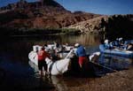
Inflatible snout boat used. Associated activities with Grand Canyon Sedimentologic Engineering: R-1-96-GC R-2-96-GC R-1-97-GC Associated activities with Colorado Sand distribution Monitoring: R-1-94-GC R-1-98-GC R-1-99-GC R-1-00-GC R-3-00-GC R-4-00-GC
Staff information imported from InfoBank
Roberto Anima (Sidescan Raft, USGS Western Region) - Chief Scientist
Dave Hogg (Sidescan Raft, USGS Western Region) - Electronics Technician
Carol Reiss (Sidescan Raft, USGS Western Region) - Documentor / Timer
Michael Hamer (Sidescan Raft, USGS Western Region) - Facs / Airphoto Nav
Bob Bohannon (Sediment Raft, USGS Western Region) - Sedimentologist
Ingrid Corson (Sediment Raft, USGS Central Region WRD) - Sediment Sampling
Paul Kinzel (Sediment Raft, USGS Central Region WRD) - Sediment Sampling
Keith Kohl (Sediment Raft, GCMRC) - Surveyor
Brian Dierker (Sidescan Raft, GCMRC) - Head River Guide
Steve Bledsoe (Sediment Raft, GCMRC) - River Guide
Larse Neimi (Kitchen Raft, GCMRC) - River Guide
Melissa Neimi (Kitchen Raft, GCMRC) - Chef
Location:
Grand Canyon
| Boundaries | |||
|---|---|---|---|
| North: 36.93518 | South: 36.84284 | West: -111.5894 | East: -111.47922 |
Platform(s):
 Raft |
| Survey Equipment | Survey Info | Data Type(s) | Data Collected |
|---|---|---|---|
| Kleinsidescan | --- | Sidescan | File list |
| GPS | --- | Navigation | Integrated navigation (SINS) data r-1-99-gc.050 Global positioning system (GPS) data r-1-99-gc.065_degree Best file with nav in ArcInfo E00 format Global positioning system (GPS) data r-1-99-gc.065 (Provisional best file) |
| bathymetry | --- | Single Beam |