AKA: none
Other ID: R-2-99-GC
Status: Completed
Organization(s):
Funding Program(s):
Principal Investigator(s): Dave Rubin, David Topping
Affiliate Investigator(s):
Information Specialist(s): Diane Minasian
Data Type(s): Electro-Magnetic: Ground Penetrating Radar, Imagery: Video, Location-Elevation: Navigation
Scientific Purpose/Goals: Sand bar work
Vehicle(s):
Start Port/Location:
End Port/Location:
Start Date: 1999-09-14
End Date: 1999-09-21
Equipment Used: 200mhzgpr, 450mhzgpr, 50mhzgpr, 50mhzgprwater, 100mhzgpr, GPS, MiniDV video camera
Information to be Derived:
Summary of Activity and Data Gathered:
Staff: Jim Bennett, Henry Chezar, Ingrid Corson, Robin Dornfest, Margie Franseen, Robert Kayen, Diane Minasian
Affiliate Staff:
Ted Mellis (GCMRC) - Geologist
Keith Kohl (GCMRC) - Civil Engineer
Notes: physical data holdings
Staff information imported from InfoBank
Dave Rubin (USGS Western Region) - Chief Scientist
David Topping (USGS Western Region) - Chief Scientist
Rob Kayen (USGS Western Region) - Geologist And Civil Engineer
Walter Barnhardt (USGS Western Region) - Geologist
Diane Minasian (USGS Western Region) - Geologist
Robin Dornfest (USGS Western Region) - Geologist
Ted Mellis (GCMRC) - Geologist
Keith Kohl (GCMRC) - Civil Engineer
Jim Bennett (USGS Western Region Denver) - Hydrologist
Ingrid Corson (USGS Western Region Denver) - Hydrologist
Margie Franseen (USGS Western Region Denver) - Hydrologist
Hank Chezar (USGS Western Region) - Photographer
Location:
Grand Canyon
| Boundaries | |||
|---|---|---|---|
| North: 36.7716 | South: 36.0546 | West: -112.513 | East: -111.6559 |
Platform(s):
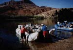
 Raft |
Barnhardt, W., Robert Kayen, David Rubin, and Diane Minasian,, 2001, The internal structure of sand bars on the Colorado River, Grand Canyon, as determined by ground-penetrating radar: U.S. Geological Survey Open-File Report 01-425, http://pubs.usgs.gov/of/2001/0425/.
| Survey Equipment | Survey Info | Data Type(s) | Data Collected |
|---|---|---|---|
| 200mhzgpr | --- | Ground Penetrating Radar | Survey information |
| 450mhzgpr | --- | Ground Penetrating Radar | Survey information |
| 50mhzgpr | --- | Ground Penetrating Radar | Survey information |
| 50mhzgprwater | --- | Ground Penetrating Radar | Survey information |
| 100mhzgpr | --- | Ground Penetrating Radar | Survey information |
| GPS | --- | Navigation | Global positioning system (GPS) data r-2-99-gc.060 (Provisional best file) Global positioning system (GPS) data r-2-99-gc.060_gazerrors Best file with nav in ArcInfo E00 format Survey information |
| MiniDV video camera | --- | Video |