AKA: none
Other ID: S-01-13-CC
Status: Completed
Organization(s): USGS, Pacific Coastal and Marine Science Center, Channel Islands Research Reserve
Funding Program(s): Coastal and marine earthquake, tsunami, and landslide active margin field studies (ZP00EQV)
Principal Investigator(s): Samuel Johnson
Affiliate Investigator(s):
Information Specialist(s): Stephen Hartwell, Ray Sliter
Data Type(s): Electro-Magnetic: Magnetics, Location-Elevation: Navigation, Seismics: Sparker
Scientific Purpose/Goals: collect geophysical data for USGS Hazards and Mapping projects
Vehicle(s):
Start Port/Location: Santa Barbara
End Port/Location: Santa Barbara
Start Date: 2013-09-20
End Date: 2013-09-29
Equipment Used: magnetometer, GPS, minisparker
Information to be Derived: seismic-reflection profiles; marine magnetic data
Summary of Activity and Data Gathered:
Staff: Stephen Hartwell, Samuel Johnson, Janet Watt, Robert Wyland
Affiliate Staff:
Notes: NOAA RV Shearwater; NOAA Channel Islands National Marine Sanctuary
Staff information imported from InfoBank
Sam Johnson
Steve Hartwell
Janet Watt
Rob Wyland
Location:
Point Sal to Gaviota
| Boundaries | |||
|---|---|---|---|
| North: 38.75 | South: 34.75 | West: -124.75 | East: -114.25 |
Platform(s):
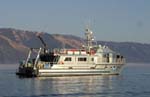 Shearwater |
| Survey Equipment | Survey Info | Data Type(s) | Data Collected |
|---|---|---|---|
| magnetometer | --- | Magnetics | |
| GPS | --- | Navigation | |
| minisparker | --- | Sparker |
