AKA: none
Other ID: S-1-06-NC
Status: Completed
Organization(s): USGS, Pacific Coastal and Marine Science Center
Funding Program(s): Coastal Change Hazards (MU051), Coastal Evolution Modeling Project (MU056)
Principal Investigator(s): Patrick Barnard
Affiliate Investigator(s):
Information Specialist(s): Patrick Barnard
Data Type(s): Location-Elevation: Navigation, Time Series: Mooring (physical oceanography)
Scientific Purpose/Goals: deploy 3 tripods
Vehicle(s):
Start Port/Location:
End Port/Location:
Start Date: 2006-01-12
End Date: 2006-01-12
Equipment Used: navigation, tripod
Information to be Derived: instrument deployment (3 tripods)
Summary of Activity and Data Gathered:
Staff: Dave Gonzales, Gerry Hatcher, Hal Williams, Joanne Thede
Affiliate Staff:
Notes:
Staff information imported from InfoBank
Gerry Hatcher
Hal Williams
Dave Gonzales
Joanne Ferreira
Location:
California
| Boundaries | |||
|---|---|---|---|
| North: 37.775 | South: 37.726 | West: -122.609 | East: -122.518 |
Platform(s):
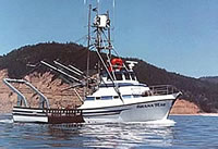 Shana Rae |
Barnard, P.L., Erikson, L.H., Hansen, J.E., and Elias, Edwin, 2009, The performance of nearshore dredge disposal at Ocean Beach, San Francisco, California, 2005-2007: U.S. Geological Survey Open-File Report 2008-1347, 93 p., http://pubs.usgs.gov/of/2008/1347/.
| Survey Equipment | Survey Info | Data Type(s) | Data Collected |
|---|---|---|---|
| navigation | --- | Navigation | Best file with nav in ArcInfo E00 format Global positioning system (GPS) data s-1-06-nc.060 (Provisional best file) |
| tripod | --- | Mooring (physical oceanography) |
