AKA: none
Other ID: S-1-61-WG,Leapfrog_Expedition
Status: Completed
Organization(s):
Funding Program(s):
Principal Investigator(s):
Affiliate Investigator(s): George Shor
Information Specialist(s):
Data Type(s): Time Series: Mooring (physical oceanography)
Scientific Purpose/Goals:
Vehicle(s):
Start Port/Location:
End Port/Location:
Start Date: 1961-08-22
End Date: 1961-08-24
Equipment Used: meters
Information to be Derived:
Summary of Activity and Data Gathered:
Staff:
Affiliate Staff:
Notes:
Staff information imported from InfoBank
George Shor - Chief Scientist
Location:
Gulf of Alaska
| Boundaries | |||
|---|---|---|---|
| North: 61.75 | South: 54 | West: -156 | East: -144.25 |
Platform(s):
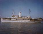 Stranger |
| Survey Equipment | Survey Info | Data Type(s) | Data Collected |
|---|---|---|---|
| meters | --- | Mooring (physical oceanography) |
