AKA: none
Other ID: none
Status: Completed
Organization(s): USGS, Pacific Coastal and Marine Science Center
Funding Program(s):
Principal Investigator(s):
Affiliate Investigator(s): V. Ralph Sobieralski
Information Specialist(s):
Data Type(s): Electro-Magnetic: Gravity, Electro-Magnetic: Magnetics, Location-Elevation: Navigation, Sonar: Single Beam
Scientific Purpose/Goals:
Vehicle(s):
Start Port/Location:
End Port/Location:
Start Date: 1966-04-07
End Date: 1966-05-07
Equipment Used: LoranA, magnetometer, gravity, transitsatellite, bathymetry
Information to be Derived: gravity, magnetics, bathymetry
Summary of Activity and Data Gathered:
Staff:
Affiliate Staff:
Notes: created Compass FAN from InfoBank entry 5/23/2016/
DATA COLLECTION OVERVIEW (use NGDC GEODAS CD to retrieve data)
MCG Data Collection ID --- S166NP
Institution Data Collection ID --- UMPSURV
NGDC ID --- 03020021
Funding --- NOAA
Project, Cruise & Leg --- OPR 454 WEST COAST UPPER MANTLE
Study region --- +39.00000,+35.00000,-133.00000,-120.00000
Chief Scientist(s) --- V. RALPH SOBIERALSKI
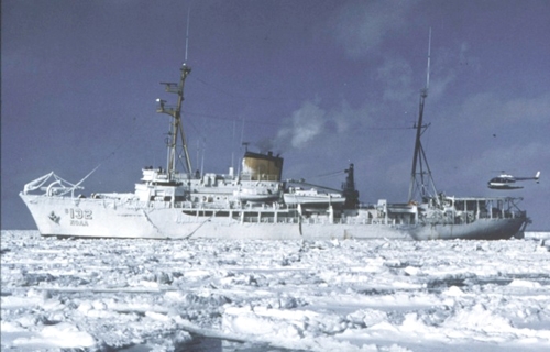
Name of vessel --- SURVEYOR (surface ship)
Date field data collection started --- 04/07/66 38.3166, -123.3616
Date field data collection ended --- 05/07/66 37.4966, -123.2783
Parameters surveyed ---
Bathymetry: surveyed, contained in data file
Magnetics: surveyed, contained in data file
Gravity: surveyed, contained in data file
High-resolution seismics: not surveyed
Deep penetration seismics: not surveyed
Format ---
(I1,A8,F5.2,4I2,F5.3,F8.5,F9.5,I1,F6.4,F6.1,I2,i1,3F6.1,I1,F5.1,F6.0,F7.1,F6.1,F5.1,A8,4I1)
Date of data input to NGDC --- 02/12/80
Contributing institution --- NOAA
Country --- USA
Location:
Northern Pacific
| Boundaries | |||
|---|---|---|---|
| North: 38.75408328 | South: 34.58416196 | West: -129.551 | East: -120.51953125 |
Platform(s):
 Surveyor |
| Survey Equipment | Survey Info | Data Type(s) | Data Collected |
|---|---|---|---|
| LoranA | --- | Navigation | |
| magnetometer | --- | Magnetics | Edited magnetics data s-1-66-np.221_050 (provisional best) |
| gravity | --- | Gravity | s-1-66-np.160_050 (provisional best) |
| transitsatellite | --- | Navigation | Integrated navigation (SINS) data/s-1-66-np.050 (provisional best) S-1-66-NP_197912_nav_plot (scanned microfilm) |
| bathymetry | --- | Single Beam | scanned microfilm (bathy) s-1-66-np.320_050 (provisional best) S-1-66-NP_153759_bathy (scanned microfilm) |
