AKA: none
Other ID: S-1-68-NS
Status: Completed
Organization(s): USGS, Pacific Coastal and Marine Science Center
Funding Program(s):
Principal Investigator(s): Gary Greene
Affiliate Investigator(s):
Information Specialist(s):
Data Type(s): Location-Elevation: Navigation, Sampling: Geology, Imagery: Video, Seismics: Ocean Bottom Seismometer
Scientific Purpose/Goals:
Vehicle(s):
Start Port/Location:
End Port/Location:
Start Date: 1968-07-23
End Date: 1968-09-17
Equipment Used: radar, RayDist, VanVeengrab, underwatertelevision, seismograph
Information to be Derived: Texture, heavy minerals, foraminifera, pebble roundness, lithology.
Summary of Activity and Data Gathered:
Staff:
Affiliate Staff:
Eugene Richards (Surveyor) - Ship Captain
Notes:
Staff information imported from InfoBank
Gary Greene (USGS Western Region) - Chief Scientist
Eugene Richards (Surveyor) - Ship Captain
Location:
Alaska
| Boundaries | |||
|---|---|---|---|
| North: 65 | South: 63 | West: -168 | East: -160 |
Platform(s):
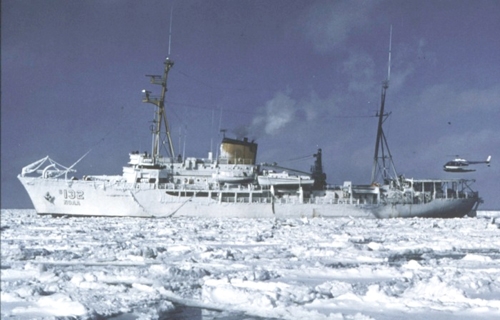 Surveyor |
Nelson, C.H., Hopkins, D.M., 1972, Sedimentary processes and distribution of particulate gold in the northern Bering Sea: U. S. Geological Survey Professional Paper 689, http://walrus.wr.usgs.gov/infobank/o/o168ns/meta/o-1-68-ns.pp_689Cite.pdf.
| Survey Equipment | Survey Info | Data Type(s) | Data Collected |
|---|---|---|---|
| radar | --- | Navigation | |
| RayDist | --- | Navigation | |
| VanVeengrab | --- | Geology | |
| underwatertelevision | --- | Video | |
| seismograph | --- | Ocean Bottom Seismometer |
