AKA: none
Other ID: S-1-69-BS
Status: Completed
Organization(s):
Funding Program(s):
Principal Investigator(s): Mike Marlow, David Scholl
Affiliate Investigator(s):
Information Specialist(s):
Data Type(s): Electro-Magnetic: Magnetics, Location-Elevation: Navigation, Seismics: Sub Bottom Profiler
Scientific Purpose/Goals:
Vehicle(s):
Start Port/Location:
End Port/Location:
Start Date: 1969-06-20
End Date: 1969-09-22
Equipment Used: magnetics, navigation, seismic
Information to be Derived:
Summary of Activity and Data Gathered:
Staff:
Affiliate Staff:
Notes:
Staff information imported from InfoBank
Dave Scholl (USGS Western Region) - Chief Scientist
Mike Marlow (USGS Western Region) - Chief Scientist
Location:
Alaska
| Boundaries | |||
|---|---|---|---|
| North: 62.9706 | South: 52.3196 | West: -175.255 | East: -166.13609 |
Platform(s):
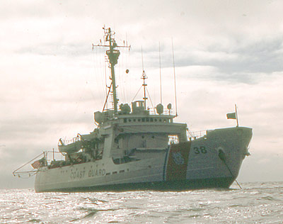 Storis |
Scholl, D.W. and M., M.S.,, 1970, Bering Sea, seismic reflection profiles, 1969: U.S. Geological Survey Open-File Report 70-292, 18 p., http://pubs.er.usgs.gov/publication/ofr70292.
Steele, W.C., Degnan, C.H., Deeter, G.B., and Riordan, J.A., 1989, Description of marine geophysical data collected by the U.S. Geological Survey and how to obtain it: U.S. Geological Survey Open-File Report 89-167, 26 p., https://pubs.er.usgs.gov/publication/ofr89167.
| Survey Equipment | Survey Info | Data Type(s) | Data Collected |
|---|---|---|---|
| magnetics | --- | Magnetics | Edited magnetics data s-1-69-bs.221_051 (Provisional best file) NGDC MGD77 data - Magnetics Raw magnetics data s-1-69-bs.201 Raw magnetics data s-1-69-bs.201_051 Raw magnetics data s-1-69-bs.200 |
| navigation | --- | Navigation | Best file with nav in ArcInfo E00 format Integrated navigation (SINS) data s-1-69-bs.050 Integrated navigation (SINS) data s-1-69-bs.051_degree Integrated navigation (SINS) data s-1-69-bs.051 (Provisional best file) |
| seismic | --- | Sub Bottom Profiler | Scan s-1-69-bs.full.tif Scan s-1-69-bs.small.tif Image s-1-69-bs.thumb.jpg |
