AKA: none
Other ID: S-1-75-EG,EGAL-75-KC
Status: Completed
Organization(s):
Funding Program(s):
Principal Investigator(s): Bruce Molnia
Affiliate Investigator(s):
Information Specialist(s): Paul Fuller
Data Type(s): Electro-Magnetic: Magnetics, Location-Elevation: Navigation, Seismics: Sparker, Seismics: Sub Bottom Profiler, Sonar: Sidescan
Scientific Purpose/Goals:
Vehicle(s):
Start Port/Location: Seattle, WA and Manchester and Juneau, AK
End Port/Location: Manchester and Juneau, AK and Juneau, AK
Start Date: 1975-04-01
End Date: 1975-04-18
Equipment Used: gradiometer, 3.5khz, sparker, minisparker, sidescansonar, magnetics, integratednavigation, transit satellite
Information to be Derived:
Summary of Activity and Data Gathered:
Staff: Ken Bayer, Duane Cavit, Becky Cruickshank, Steve Davenport, Paul Fuller, Jim Joyce, Jim Nicholson, Gordon Tanner, Frances Wahl, Steve Wallace, Lisa Wright
Affiliate Staff:
Notes:
Staff information imported from InfoBank
Bruce Molnia (USGS Western Region) - Chief Scientist
Paul Fuller (USGS Western Region) - Dafe Coordinator
Ken Bayer (USGS Western Region) - Geophysicist
Jim Nicholson (USGS Western Region) - Electronic Technician
Gordon Tanner (USGS Western Region) - Electronic Technician
Duane Cavit (USGS Western Region) - Watchstander
Becky Cruickshank (USGS Western Region) - Watchstander
Steve Davenport (USGS Western Region) - Watchstander
Jim Joyce (USGS Western Region) - Watchstander
Frances Wahl (USGS Western Region) - Watchstander
Steve Wallace (USGS Western Region) - Watchstander
Lisa Wright (USGS Western Region) - Watchstander
McDonald (NOAA) - Captain
Location:
Eastern Gulf of Alaska
| Boundaries | |||
|---|---|---|---|
| North: 60.625 | South: 57.7201 | West: -152.375 | East: -136.58501 |
Platform(s):
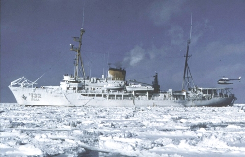 Surveyor |
Carlson P.R., and M., B.F., 1977, Faulting, instability, erosion, and deposition of shelf sediments, eastern Gulf of Alaska, in Environmental assessment of the Alaskan continental shelf; Hazards: Boulder, CO, U.S. Department of Commerce Environmental Resource Laboratories.
Carlson, P.R., and Molnia, B.F, 1977, Submarine faults and slides on the continental shelf, northern Gulf of Alaska, in Richards, A.F., ed., Marine slope stability: Marine Geotechnology, v. 2, pp. 275–290.
Carlson, P.R., and Molnia, B.F., 1976, Faulting and instability of shelf sediments; eastern Gulf of Alaska, in Environmental assessment of the Alaskan continental shelf: Geology, v. 13.
Carlson, P.R., Bruns, T.R., Molnia, B., and Hampson, J.C., Jr., 1977, Submarine valleys on the continental shelf, northeastern Gulf of Alaska: Geological Society of America Abstracts with Programs, v. 9 no. 7, pp. 921–921.
Carlson, P.R., Molnia, B.F., and Quinterno, P., 1978, Transport of inner shelf sediment into glacially scoured troughs, northeastern Gulf of Alaska: American Geophysical Union Eos, Transactions, v. 59 no. 12, pp. 1109–1109.
Carlson, P.R., Molnia, B.F., and Reimnitz, E., 1976, Dispersal, distribution and thickness of Holocene sediments on the continental shelf, northern Gulf of Alaska, in Fritsche, A.E., Ter Best, H., Jr, Wornardt, W.W., eds. The Neogene symposium; selected technical papers on paleontology, sedimentology, petrology, tectonics and geologic history of the Pacific Coast of North America: Society of Economic Paleontologists and Mineralogists.
Carlson, P.R., Molnia, B.F., and Reimnitz, E., 1976, Dispersal, distribution, and thickness of Holocene sediments on continental shelf, northern Gulf of Alaska: American Association of Petroleum Geologists Bulletin, v. 60 no. 12, pp. 2176–2177.
Carlson, P.R., Molnia, B.F., Kittelson, S.C., and Hampson, J.C., Jr., 1977, Map of distribution of bottom sediments on the continental shelf, northern Gulf of Alaska: U. S. Geological Survey Miscellaneous Field Studies Map MF-0876.
Carlson, P.R., and Molnia, Bruce F., 1976, Submarine mass movement of Holocene sediments seaward of the Copper River: U. S. Geological Survey Circular 0733, pp. 55–56.
Carlson, P.R., and Schwab, William C., 1982, Northern Gulf of Alaska environmental geology, in Bruns, T. R., ed., Hydrocarbon resource report for proposed OCS lease sale 88; southeastern Alaska, northern Gulf of Alaska, Cook Inlet, and Shelikof Strait, Alaska: U.S. Geological Survey Open-File Report 82-0928, pp. 73–86.
Carlson, P.R., Bruns, Terry R., Molnia, Bruce F., and Schwab, William C., 1982, Submarine valleys in the northeastern Gulf of Alaska; characteristics and probable origin: Marine Geology, v. 47 no. 3-4, pp. 217–242.
Molnia, B., Carlson, P.R., and Bruns, T.R., 1977, Large submarine slide in Kayak Trough, Gulf of Alaska: Reviews in Engineering Geology, v. 3, pp. 137–148.
Molnia, B.F., and Carlson, P.R, 1978, Surface sedimentary units of northern Gulf of Alaska continental shelf: American Association of Petroleum Geologists Bulletin, v. 62 no. 4, pp. 633–643.
Molnia, B.F., and Carlson, P.R., 1976, Erosion and deposition of shelf sediment; eastern Gulf of Alaska, in Environmental assessment of the Alaskan continental shelf: Geology, v. 13.
Molnia, B.F., and Carlson, P.R., 1975, Geology of Pamplona Ridge, northern Gulf of Alaska: , Geological Society of America Abstracts with Program. , pp. 1203–1203.
Molnia, B.F., Carlson, P.R., and Bruns, T.R., 1976, Geologic hazards in the northern Gulf of Alaska: , Geological Society of America Abstracts with Programs. , pp. 396–397.
Molnia, B.F., Carlson, P.R., and Levy, W.P., 1978, Holocene sediment volume and modern sediment yield, Northeast Gulf of Alaska: American Association of Petroleum Geologists Bulletin, v. 62 no. 3, pp. 545–545.
Molnia, B.F., Carlson, P.R., and Levy, W.P., 1979, Holocene sediment volume on the northeast Gulf of Alaska Continental Shelf and the sediment contribution of present-day river: U. S. Geological Survey Professional Paper 1150, pp. 151–152.
Molnia, B.F., Carlson, P.R., and Wright, L.H., 1978, Geophysical data from the 1975 cruise of the NOAA ship Surveyor in northern Gulf of Alaska: U.S. Geological Survey Open-File Report 78-209, 42 p.
Molnia, B.F., Levy, W.P., and Carlson, P.R., 1980, Map showing Holocene sedimentation rates in the northeastern Gulf of Alaska: U. S. Geological Survey Miscellaneous Field Studies Map MF-1170, 1 p.
Molnia, B.F., and Carlson, P.R., 1980, Quaternary sedimentary facies of the northeast Gulf of Alaska Continental Shelf: U. S. Geological Survey Professional Paper 1175, pp. 158–159.
Molnia, B.F., and Carlson, P.R., 1980, Quaternary sedimentary facies on continental shelf, Northeast Gulf of Alaska: American Association of Petroleum Geologists Bulletin, v. 64 no. 3, pp. 446–447.
Molnia, B.F., Kvenvolden, K.A., Redden, G.D., Carlson, P.R., Bruns, T.R., Molnia, B.F., Hampson, J.C., Jr., and Schwab, W.C., 1978, Environmental geologic studies, northeastern Gulf of Alaska: U. S. Geological Survey Professional Paper 1100, pp. 153–155.
Molnia, B.F., and Carlson, Paul R., 1976, Surface sedimentary units of the northern Gulf of Alaska continental shelf: U. S. Geological Survey Circular 0733, pp. 56–57.
Steele, W.C., Degnan, C.H., Deeter, G.B., and Riordan, J.A., 1989, Description of marine geophysical data collected by the U.S. Geological Survey and how to obtain it: U.S. Geological Survey Open-File Report 89-167, 26 p., https://pubs.er.usgs.gov/publication/ofr89167.
Wilde, P., Normark, W.R., and Chase, T.E., 1974, Petroleum potential on continental rise off central California, in Circum-Pacific Energy and Mineral Resources Conference: American Association of Petroleum Geologists Bulletin, v. 58 no. 7, pp. 1461–1462.
| Survey Equipment | Survey Info | Data Type(s) | Data Collected |
|---|---|---|---|
| gradiometer | --- | Magnetics | NGDC MGD77 data - Magnetics Free Air Anomaly data s-1-75-eg.161 Free Air Anomaly data s-1-75-eg.161_052 (Provisional best file) |
| 3.5khz | --- | Sub Bottom Profiler | NGDC MGD77 data - bathy Raw depth (bathymetry) data s-1-75-eg.305 Raw depth (bathymetry) data s-1-75-eg.305_052 (Provisional best file) |
| sparker | --- | Sparker | |
| minisparker | --- | Sparker | |
| sidescansonar | --- | Sidescan | |
| magnetics | --- | Magnetics | |
| integratednavigation | --- | Navigation | Best file with nav in ArcInfo E00 format Integrated navigation (SINS) data s-1-75-eg.052 (Provisional best file) Integrated navigation (SINS) data s-1-75-eg.052_degree |
| transit satellite | --- | Navigation | Satellite data s-1-75-eg.000 |
