AKA: none
Other ID: S-1-84-CS
Status: Completed
Organization(s):
Funding Program(s):
Principal Investigator(s): Larry Phillips
Affiliate Investigator(s):
Information Specialist(s):
Data Type(s): Sonar: Single Beam, Seismics: Sub Bottom Profiler, Sonar: Sidescan, Environmental Data: Current, Location-Elevation: Navigation, Sampling: Biology, Sampling: Geology, Seismics: Boomer
Scientific Purpose/Goals:
Vehicle(s):
Start Port/Location: Nome, AK
End Port/Location: Nome, AK
Start Date: 1984-08-28
End Date: 1984-09-15
Equipment Used: 12khz, 3.5khz, bathymetry, sidescansonar, bottomdrifter, rangerange, transitsatellite, boxcore, gravitycore, pipedredge, uniboom
Information to be Derived:
Summary of Activity and Data Gathered:
Staff: Peter Barnes, Michael Boyle, John Chin, Jon Erickson, Scott Graves, Ralph Hunter, Ed Kempema, Doug Rearic, Toby Scott, Thomas Reiss
Affiliate Staff:
Notes:
Staff information imported from InfoBank
Peter Barnes (USGS Western Region) - Geologist
Mike Boyle (USGS Western Region) - Electronics Technician
John Chin (USGS Western Region) - Geologist
Jon Erickson (USGS Western Region) - Mechanical Technician
Scott Graves (USGS Western Region) - Geologist
Ralph Hunter (USGS Western Region) - Geologist
Ed Kempema (USGS Western Region) - Geologist
Larry Phillips (USGS Western Region) - Chief Scientist
Doug Rearic (USGS Western Region) - Geologist
Tom Reiss (USGS Western Region) - Oceanographer
Toby Scott (USGS Western Region) - Geologist
Location:
Alaska
| Boundaries | |||
|---|---|---|---|
| North: 71.61256 | South: 68.72246 | West: -168.5548 | East: -158.01566 |
Platform(s):
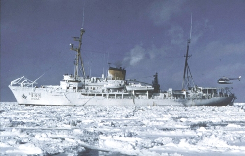 Surveyor |
Philllips, R.L., Barnes, P.W., Hunter, R.E., Reiss, T.E., and Rearic, D.M., 1988, Geologic investigations in the Chukchi Sea, 1984, NOAA ship Surveyor cruise: U.S. Geological Survey Open-File Report 88-25, http://pubs.usgs.gov/of/1988/0025/report.pdf.
| Survey Equipment | Survey Info | Data Type(s) | Data Collected |
|---|---|---|---|
| 12khz | --- | Single Beam | NGDC MGD77 data - bathy |
| 3.5khz | --- | Sub Bottom Profiler | |
| bathymetry | --- | Single Beam | |
| sidescansonar | --- | Sidescan | File list |
| bottomdrifter | --- | Current | |
| rangerange | --- | Navigation | Eotvos/course/speed/distance data s-1-84-cs.071 (Provisional best file) |
| transitsatellite | --- | Navigation | |
| boxcore | --- | Biology Geology | |
| gravitycore | --- | Geology | |
| pipedredge | --- | Geology | |
| uniboom | --- | Boomer |
