AKA: none
Other ID: S-1-88-EG,S-1-88-EGAL
Status: Completed
Organization(s): USGS, Pacific Coastal and Marine Science Center
Funding Program(s):
Principal Investigator(s): Paul Carlson
Affiliate Investigator(s):
Information Specialist(s):
Data Type(s): Sonar: Single Beam
Scientific Purpose/Goals: Mapping the bathymetry on the continental slope of the Gulf of Alaska using seabeam bathymetry.
Vehicle(s):
Start Port/Location:
End Port/Location:
Start Date: 1988-07-25
End Date: 1988-08-12
Equipment Used: bathymetry
Information to be Derived:
Summary of Activity and Data Gathered:
Staff:
Affiliate Staff:
William Stubblefield - Ship Captain
Notes: The NOAA Seabeam data were collected during July and August, 1988, on the NOAA ship SURVEYOR S-1-88 EGAL under direction of Capt. Wm. Stubblefield. I was the only USGS person onboard for a part of the data collection from the Gulf of Alaska along the continental slope-- long. 143-150. The sheets include processed seabeam bathymetry done by NOAA, and overlay sheets that I made on board the ship. These overlays are interpretations of the seafloor morphology. Paul Carlson.
Staff information imported from InfoBank
Paul Carlson (USGS Western Region) - Chief Scientist
William Stubblefield - Ship Captain
Location:
Eastern Gulf of Alaska
| Boundaries | |||
|---|---|---|---|
| North: 61.75 | South: 57.25 | West: -144 | East: -132 |
Platform(s):
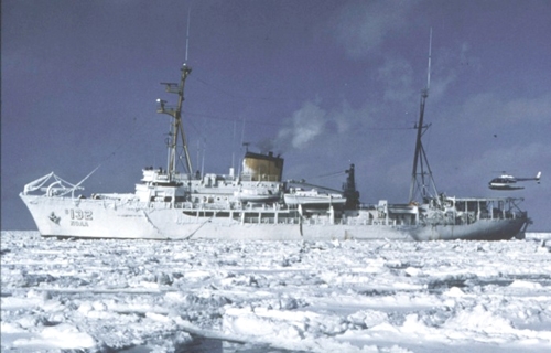 Surveyor |
| Survey Equipment | Survey Info | Data Type(s) | Data Collected |
|---|---|---|---|
| bathymetry | --- | Single Beam |
