AKA: none
Other ID: S-1-90-MB,Dive 835
Status: Completed
Organization(s): USGS, Pacific Coastal and Marine Science Center
Funding Program(s): Monterey Canyon Cold-seep communities and Geologic Processes (MU185)
Principal Investigator(s): Steve Eittreim
Affiliate Investigator(s):
Information Specialist(s): Steve Eittreim
Data Type(s): Sampling: Geology, Imagery: Video, Imagery: Photo
Scientific Purpose/Goals: Sampling of cold seep communities, video and still photography
Vehicle(s):
Start Port/Location:
End Port/Location:
Start Date: 1990-07-06
End Date: 1990-07-11
Equipment Used: grab, submersible
Information to be Derived:
Summary of Activity and Data Gathered:
Staff: Steve Eittreim
Affiliate Staff:
Bob Embley - NOAA
Barbara Hecker (Doherty) - Lamont
Notes: physical data holdings
Information about this activity derived from Quick-look Report submitted to NOAA July 16, 1990
Staff information imported from InfoBank
Steve Eittreim - USGS
Bob Embley - NOAA
Barbara Hecker (Doherty) - Lamont
Location:
Monterey Canyon
| Boundaries | |||
|---|---|---|---|
| North: 37 | South: 36.75 | West: -122.5 | East: -121.75 |
Platform(s):
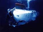 Sea Cliff |
| Survey Equipment | Survey Info | Data Type(s) | Data Collected |
|---|---|---|---|
| grab | --- | Geology | |
| submersible | --- | Photo Video Biology Geology |
