AKA: none
Other ID: S-1C-08-SC
Status: Completed
Organization(s): USGS, Pacific Coastal and Marine Science Center
Funding Program(s): CA State Waters (MU039)
Principal Investigator(s): Peter Dartnell
Affiliate Investigator(s):
Information Specialist(s): Peter Dartnell
Data Type(s): Imagery: Photo, Location-Elevation: Navigation
Scientific Purpose/Goals:
Vehicle(s):
Start Port/Location:
End Port/Location:
Start Date: 2008-09-28
End Date: 2008-10-08
Equipment Used: camera, GPS
Information to be Derived:
Summary of Activity and Data Gathered:
Staff:
Affiliate Staff:
Notes: proposed; 10 days.
Location:
Santa Barbara Channel
| Boundaries | |||
|---|---|---|---|
| North: 34.46728 | South: 34.06622 | West: -120.471 | East: -119.09138 |
Platform(s):
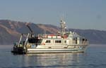 Shearwater |
Johnson, S.Y., Dartnell, P., Cochrane, G.R., Golden, N.E., Phillips, E.L., Ritchie, A.C., Kvitek, R.G., Greene, H.G., Krigsman, L.M., Endris, C.A., Clahan, K.B., Sliter, R.W., Wong, F.L., Yoklavich, M.M., and Normark, W.R.(S.Y.J., ed.), 2012, California State Waters Map Series--Hueneme Canyon and vicinity, California: U.S. Geological Survey Scientific Investigations Map 3225, 41 p.
FAN S1C08SC has data viewable in the CMGP Video and Photograph Portal. View the data in this application here. See the instructions for working with this application.
| Survey Equipment | Survey Info | Data Type(s) | Data Collected |
|---|---|---|---|
| camera | --- | Photo | Line44 Line07 Line02 Line43 Line03 Line04 Line05 Line06 Line08 Line09 Line10 Line11 Line12 Line13 Line14 Line15 Line16 Line17 Line19 Line20 Line21 Line22 Line23 Line24 Line26 Line34 Line35 Line37 Line38 Line39 Line40 Line41 Line45 Line46 Line47 Line48 Line49 Line50 Habitat--Offshore of Refugio Beach, California (This part of DS 781 presents the habitat map of the Offshore of Refugio Beach map area, California. The vector data file is included in ""Habitat_RefugioBeach.zip,"" which is accessible from https://pubs.usgs.gov/ds/781/OffshoreRefugioBeach/data_catalog_OffshoreRefugioBeach.html. These data accompany the pamphlet and map sheets of Johnson, S.Y., Dartnell, P., Cochrane, G.R., Golden, N.E., Phillips, E.L., Ritchie, A.C., Krigsman, L.M., Dieter, B.E., Conrad, J.E., Greene, H.G., Seitz, G.G., Endris, C.A., Sliter, R.W., Wong, F.L., Erdey, M.D., Gutierrez, C.I., Yoklavich, M.M., East, A.E., and Hart, P.E. (S.Y. Johnson and S.A. Cochran, eds.), 2015, California State Waters Map Series--Offshore of Refugio Beach, California: U.S. Geological Survey Scientific Investigations Map 3319, pamphlet 42 p., 11 sheets, scale 1:24,000, https://doi.org/10.3133/sim3319. Potential marine benthic habitat maps were constructed using multibeam echosounder (MBES) bathymetry and backscatter data. The habitats were based on substrate types and documented or ""ground truthed"" using underwater video images and seafloor samples obtained by the USGS. These maps display various habitat types that range from flat, soft, unconsolidated sediment-covered seafloor to hard, deformed (folded), or highly rugose and differentially eroded bedrock exposures.) s1c08sc_video_observations (This part of DS 781 presents video observations from cruise S1C08SC for the Santa Barbara Channel region and beyond in southern California. The vector data file is included in ""s1c08sc_video_observations.zip,"" which is accessible from https://pubs.usgs.gov/ds/781/video_observations/data_catalog_video_observations.html. Between 2006 and 2007, the seafloor southern California was mapped by California State University, Monterey Bay, Seafloor Mapping Lab (CSUMB) and by the U.S. Geological Survey (USGS), using both multibeam echosounders and bathymetric sidescan sonar units. These mapping missions combined to collect bathymetry and acoustic-backscatter data from about the 10-m isobath to out beyond the 3-nautical-mile limit of California's State Waters. To validate the interpretations of sonar data in order to turn it into geologically and biologically useful information, the USGS ground-truth surveyed the data by towing camera sleds over specific locations throughout the region. During the 2008 ground-truth cruise, the camera sled housed two video cameras (one forward looking and the other vertical looking), a high-definition video camera, and an 8-megapixel digital still camera. The video was fed in real time to the research vessel, where USGS and NOAA scientists recorded both the geologic and biologic character of the seafloor into programmable keypads once every minute. In addition to recording the seafloor characteristics, a digital still photograph was captured once every 30 seconds. This ArcGIS shape file includes the position of the camera, the time each observation was started, and the visual observations of geologic and biologic habitat.) Highlights Line18 |
| GPS | --- | Navigation | Best file with nav in ArcInfo E00 format Global positioning system (GPS) data s-1c-08-sc.060 (Provisional best file) |
