AKA: none
Other ID: S-2-07-MK
Status: Completed
Organization(s): USGS, Pacific Coastal and Marine Science Center, University of Washington, USGS, National Mapping Division, Flagstaff
Funding Program(s): Geologic Processes on Coral Reefs (MU117)
Principal Investigator(s): Pat Chavez, Michael Field
Affiliate Investigator(s):
Information Specialist(s): Pat Chavez, Susan Cochran, Joshua Logan
Data Type(s): Imagery: Other Imagery, Imagery: Photo, Location-Elevation: LIDAR, Sampling: Geology
Scientific Purpose/Goals: Reoccupy transects from April 2005 to resurvey sediment and processes on the Molokai reef flat, including multi-spectral imaging overflight; survey of upland landscape conditions; collection of nearshore samples along south shore to recon forams (samples for Mary McGann)
Vehicle(s):
Start Port/Location: Kaunakakai, Molokai, HI
End Port/Location: Kaunakakai, Molokai, HI
Start Date: 2007-05-13
End Date: 2007-05-22
Equipment Used: grab, multi-spectral imaging, camera, LIDAR
Information to be Derived: processes and volume of suspended sediment in water column; survey of foraminifera on the south shore to determine changes along-coast; survey of upland landscape to determine sediment source information
Summary of Activity and Data Gathered: Ridge-to-Reef data collections: Survey of suspended sediment concentrations on the reef flat at multiple times throughout the day during a spring high tide/high trade wind cycle, including simultaneous collection of multi-spectral imagery; survey of foraminifera on the south shore to determine changes along-coast; survey of upland landscape to determine sediment source information.
Staff: Rian Bogle, Olivia Buchan, Susan Cochran, Joshua Logan, Thomas Reiss, Michael Torresan
Affiliate Staff:
Andrea Ogston (backpack profiler operation
University of Washington) - Tripod instrumentation
Kurt Rosenburg (instrumentation
USGS Santa Cruz) - Data collection
Jon Stock (USGS Menlo Park) - landscape surveys
Kevin Schmidt (USGS Menlo Park) - landscape surveys
Notes: Platforms used; helicopter, small zodiac inflatable boat, and possibly the Alyce C (boat) if needed for collecting samples in deeper waters on the forereef.
Staff information imported from InfoBank
Mike Field (USGS Santa Cruz) - Chief Scientist
Pat Chavez (USGS Flagstaff) - Chief Scientist
Susie Cochran (data collection, sample processing, logistics, USGS Santa Cruz) - Information specialist
Josh Logan (navigation, instrumentation, vessel operation, USGS Santa Cruz) - Information specialist
Andrea Ogston (backpack profiler operation, University of Washington) - Tripod instrumentation
Mike Torresan (sample processing, USGS Menlo Park) - Data collection
Olivia Buchan (sample processing, USGS Menlo Park) - Data collection
Tom Reiss (navigation, instrumentation, vessel operation, USGS Menlo Park) - Data collection
Kurt Rosenburg (instrumentation, USGS Santa Cruz) - Data collection
Rian Bogle (USGS Flagstaff) - Camera operations
Jon Stock (USGS Menlo Park) - landscape surveys
Kevin Schmidt (USGS Menlo Park) - landscape surveys
Location:
Hawaii
| Boundaries | |||
|---|---|---|---|
| North: 21.25 | South: 21 | West: -157.5 | East: -156.75 |
Platform(s):
 Alyce C | 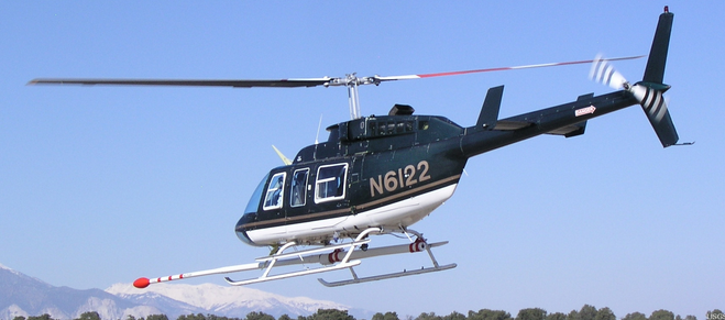 Helicopter | 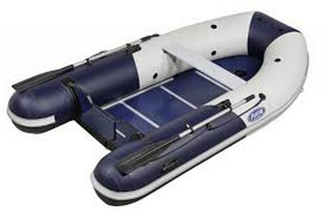 Zodiac |
| Survey Equipment | Survey Info | Data Type(s) | Data Collected |
|---|---|---|---|
| grab | --- | Geology | |
| multi-spectral imaging | --- | Other Imagery | |
| camera | --- | Photo | |
| LIDAR | --- | LIDAR |
