AKA: none
Other ID: S-2-75-EG,EGAL-75-KC
Status: Completed
Organization(s):
Funding Program(s):
Principal Investigator(s): Paul Carlson
Affiliate Investigator(s):
Information Specialist(s): Paul Fuller
Data Type(s): Electro-Magnetic: Magnetics, Seismics: Sub Bottom Profiler, Seismics: Sparker
Scientific Purpose/Goals:
Vehicle(s):
Start Port/Location: Juneau, AK
End Port/Location: Coast Guard Pier, Kodiak Island, AK
Start Date: 1975-04-21
End Date: 1975-05-02
Equipment Used: gradiometer, 3.5khz, sparker, minisparker
Information to be Derived:
Summary of Activity and Data Gathered:
Staff: Ken Bayer, Jim Nicholson, Lisa Wright
Affiliate Staff:
Notes:
Staff information imported from InfoBank
Paul Carlson (USGS Western Region) - Chief Scientist
Ken Bayer (USGS Western Region) - Geophysicist
Jim Nicholson (USGS Western Region) - Electronic Technician
Lisa Wright (USGS Western Region) - Watchstander
Location:
Eastern Gulf of Alaska
| Boundaries | |||
|---|---|---|---|
| North: 61.75 | South: 57.25 | West: -144 | East: -132 |
Platform(s):
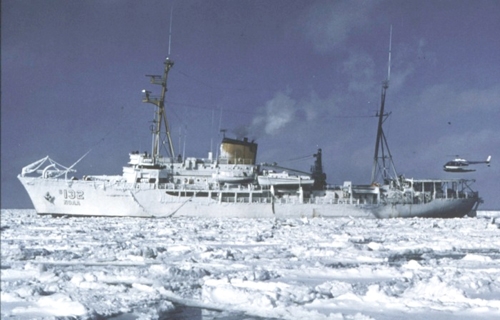 Surveyor |
Carlson, P.R., and Molnia, Bruce F., 1976, Submarine mass movement of Holocene sediments seaward of the Copper River: U. S. Geological Survey Circular 0733, pp. 55–56.
Carlson, P.R., and Schwab, William C., 1982, Northern Gulf of Alaska environmental geology, in Bruns, T. R., ed., Hydrocarbon resource report for proposed OCS lease sale 88; southeastern Alaska, northern Gulf of Alaska, Cook Inlet, and Shelikof Strait, Alaska: U.S. Geological Survey Open-File Report 82-0928, pp. 73–86.
Carlson, P.R., Bruns, Terry R., Molnia, Bruce F., and Schwab, William C., 1982, Submarine valleys in the northeastern Gulf of Alaska; characteristics and probable origin: Marine Geology, v. 47 no. 3-4, pp. 217–242.
Molnia, B.F., Carlson, P.R., and Wright, L.H., 1978, Geophysical data from the 1975 cruise of the NOAA ship Surveyor in northern Gulf of Alaska: U.S. Geological Survey Open-File Report 78-209, 42 p.
Molnia, B.F., and Carlson, Paul R., 1976, Surface sedimentary units of the northern Gulf of Alaska continental shelf: U. S. Geological Survey Circular 0733, pp. 56–57.
| Survey Equipment | Survey Info | Data Type(s) | Data Collected |
|---|---|---|---|
| gradiometer | --- | Magnetics | |
| 3.5khz | --- | Sub Bottom Profiler | |
| sparker | --- | Sparker | |
| minisparker | --- | Sparker |
