AKA: S0307SC
Other ID: S-3-07-SC,07036
Status: Completed
Organization(s): USGS, Pacific Coastal and Marine Science Center
Funding Program(s): CA Urban Oceans project (MU040)
Principal Investigator(s): Jingping Xu
Affiliate Investigator(s):
Information Specialist(s): Joanne Thede
Data Type(s): Environmental Data: CTD, Location-Elevation: Navigation, Sampling: Geology, Time Series: Mooring (physical oceanography)
Scientific Purpose/Goals: Deployed two moorings one in Mugu Canyon, one in Hueneme Canyon Collected CTD casts, Collected grab samples
Vehicle(s):
Start Port/Location: San Diego, CA
End Port/Location: San Diego, CA
Start Date: 2007-09-11
End Date: 2007-09-13
Equipment Used: CTD, GPS, tripod, grab
Information to be Derived: A CD that contains ship-board Meterological data and Echo sounder collection during the operation. The latter also include event marks with time, position, and water depth of mooring, CTD, and grab drops.
Summary of Activity and Data Gathered: Two moorings deployed, 9 CTD casts, 5 grab samples
Staff: Joanne Thede, Dave Gonzales, Marlene Noble, Kurt Rosenberger, Hal Williams
Affiliate Staff:
Rick Rendigs (USGS
WH) - MT
Notes: Staff information imported from InfoBank
Jingping Xu (USGS) - Chief scientist
Joanne Ferreira (USGS) - Data specialist
Marlene Noble (USGS) - Scientist
Dave Gonzales (USGS) - ET
Hal Williams (USGS) - MT
Jonathan Borden (USGS, WH) - ET
Kurt Rosenberger (USGS) - Scientist
Rick Rendigs (USGS, WH) - MT
Location:
Southern California
| Boundaries | |||
|---|---|---|---|
| North: 34.13865 | South: 34.07357 | West: -119.231 | East: -119.09207 |
Platform(s):
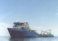 Robert Gordon Sproul |
| Survey Equipment | Survey Info | Data Type(s) | Data Collected |
|---|---|---|---|
| CTD | --- | Surveys (geochemical) Experiments (geochemical) CTD | Station Information |
| GPS | --- | Navigation | Best file with nav in ArcInfo E00 format Global positioning system (GPS) data s-3-07-sc.060 (Provisional best file) |
| tripod | --- | Mooring (physical oceanography) | Station Information |
| grab | --- | Geology |
