AKA: none
Other ID: S-I1-09-SC
Status: Completed
Organization(s): USGS, Pacific Coastal and Marine Science Center
Funding Program(s):
Principal Investigator(s): Jonathan Warrick
Affiliate Investigator(s): Jon Warrick
Information Specialist(s): Joanne Thede
Data Type(s): Environmental Data: Current, Environmental Data: Turbidity, Location-Elevation: Navigation
Scientific Purpose/Goals: Deployment of tripods and buoy to gather time-series data on near-bottom and water column sediment transport and tidal/wind-driven mixing. Work is intended to monitor sediment transport events following sediment placement on the beach and outflow from the Tijuana River.
Vehicle(s):
Start Port/Location: Scripps Marine Facility, San Diego, CA
End Port/Location: Scripps Marine Facility, San Diego, CA
Start Date: 2009-02-25
End Date: 2009-02-26
Equipment Used: current profilers, opticalbackscattersensor, transmissometer, GPS, acousticdoppler
Information to be Derived: Time-series data on near-bottom and water column sediment transport and tidal/wind-driven mixing, effects of flow and bottom stresses on transport rates
Summary of Activity and Data Gathered: 6 stations
Staff: Peter Dal Ferro, Joanne Thede, Dave Gonzales, Kurt Rosenberger
Affiliate Staff:
Jon Warrick
Notes: Moorings were deployed during field activity 08044: 08044. Inner Shelf Sediment Transport near the Tijuana Estuary
Staff information imported from InfoBank
Jon Warrick
Joanne Ferreira
Dave Gonzales
Kurt Rosenberger
Pete Dal Ferro
Location:
San Diego to the U.S.-Mexico Border
| Boundaries | |||
|---|---|---|---|
| North: 32.54855 | South: 32.54018 | West: -117.158 | East: -117.13852 |
Platform(s):
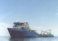 Robert Gordon Sproul |
Warrick, J.A., Rosenberger, K., Lam, A., Ferreira, J., Miller, I.M., Rippy, M., Svejkovsky, J., and Mustain, N., 2012, Observations of coastal sediment dynamics of the Tijuana Estuary Fine Sediment Fate and Transport Demonstration Project, Imperial Beach, California: U.S. Geological Survey Open-File Report 2012-1083, 29 p., http://pubs.usgs.gov/of/2012/1083/.
| Survey Equipment | Survey Info | Data Type(s) | Data Collected |
|---|---|---|---|
| current profilers | --- | Current | Station Information |
| opticalbackscattersensor | --- | Turbidity | |
| transmissometer | --- | Turbidity | |
| GPS | --- | Navigation | Best file with nav in ArcInfo E00 format Global positioning system (GPS) data s-i1-09-sc.060 (Provisional best file) |
| acousticdoppler | --- | Current |
