AKA: none
Other ID: S-P1-10-SC
Status: Completed
Organization(s): USGS, Pacific Coastal and Marine Science Center
Funding Program(s):
Principal Investigator(s): Christopher Sherwood
Affiliate Investigator(s):
Information Specialist(s):
Data Type(s): Environmental Data: CTD, Location-Elevation: Navigation, Sampling: Geology
Scientific Purpose/Goals: Sediment samples from Palos Verdes for size analysis, in conjunction with USGS Reston (Eganhouse) chemical sampling, funded by US EPA.
Vehicle(s):
Start Port/Location: Scripps MARFAC, San Diego and Scripps MARFAC, San Diego
End Port/Location: Scripps MARFAC, San Diego and Scripps MARFAC, San Diego
Start Date: 2010-04-22
End Date: 2010-04-25
Equipment Used: CTD, GPS, grab sampler
Information to be Derived: Grain size analysis;
Summary of Activity and Data Gathered: WH group arrive San Diego Tues 20 April 2010; mob ship at Scripps Nimitz Marine Facility. Delay one day for weather, depart Scripps 1700 PDT 22 April. Arrive onsite 0600 PDT 23 April; Grab sample until noon; Eganhouse box core until midnight; grab sample until noon on 24 April; box core and CTD at 8C, 6C, and 3C on shelf until 1800; transit to San Pedro Channel; CTD and box core until 2200 PDT; transit back to port; arrive Scripps Marfac at 0845 PDT Sunday 25 April 2010. Unload ship and travel home.
Staff:
Affiliate Staff:
Notes: Days at Sea: 4 Navigation technique: gps;Ships GPS and USGS-WCMG Yo-Nav system. Post-processing to a) compare locations from two systems and b) adjust for heading and distance from GPS antennae to fantail. Degree of Certainty: 100 Mooring Information: S-P1-10-SC Science Strategy: Ecosystems;Human Health; Submitted by: Chris Sherwood Report Date: 2010-06-30
Location:
North Pacific;
| Boundaries | |||
|---|---|---|---|
| North: 35.75 | South: 32.25 | West: -122.25 | East: -114.25 |
Platform(s):
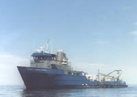 Robert Gordon Sproul |
| Survey Equipment | Survey Info | Data Type(s) | Data Collected |
|---|---|---|---|
| CTD | --- | Surveys (geochemical) Experiments (geochemical) CTD | |
| GPS | --- | Navigation | |
| grab sampler | --- | Surveys (geochemical) Geology |
