AKA: none
Other ID: S-W1-09-SC
Status: Completed
Organization(s): USGS, Pacific Coastal and Marine Science Center
Funding Program(s): California State Mapping Project (MU031)
Principal Investigator(s): Peter Dartnell, Brian Edwards
Affiliate Investigator(s):
Information Specialist(s):
Data Type(s): Imagery: Video, Location-Elevation: Navigation
Scientific Purpose/Goals: Video ground-truthing for seafloor geology and habitat mapping
Vehicle(s):
Start Port/Location: Santa Barbara, CA
End Port/Location: Santa Barbara, CA
Start Date: 2009-08-10
End Date: 2009-08-21
Equipment Used: Underwatervideo, GPS
Information to be Derived: Seafloor geology, biology, and habitat
Summary of Activity and Data Gathered: WCMG will collect seafloor video, still photographs, and record real-time observations that will be used to ground-truth seafloor geology, habitat, and character maps created for the California State Mapping Project.
Staff: Henry Chezar, Jackson Currie, Timothy Elfers, Nadine Golden, Peter Harkins
Affiliate Staff:
Eleyne Phillips (USGS) - geologist
Lisa Krigsman (NOAA) - biologist
Lisa Gilbane (MMS) - biologist
Notes: Staff information imported from InfoBank
Pete Dartnell (USGS) - Chief Scientist
Brian Edwards (chief scientist, USGS) - Co
Eleyne Phillips (USGS) - geologist
Lisa Krigsman (NOAA) - biologist
Jackson Currie (USGS) - ET
Peter Harkins (USGS) - MT
Hank Chezar (USGS) - photographic specialist
Tim Elfers (USGS) - MT
Lisa Gilbane (MMS) - biologist
Nadine Golden (USGS) - geographer
Non USGS data manager = Eleyne Phillips
Location:
southern CA
| Boundaries | |||
|---|---|---|---|
| North: 34.51407 | South: 33.28076 | West: -120.555 | East: -118.27508 |
Platform(s):
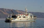 Shearwater |
FAN SW109SC has data viewable in the CMGP Video and Photograph Portal. View the data in this application here. See the instructions for working with this application.
| Survey Equipment | Survey Info | Data Type(s) | Data Collected |
|---|---|---|---|
| Underwatervideo | --- | Video | sw109sc_video_observations (This part of DS 781 presents video observations from cruise SW109SC for the Santa Barbara Channel region and beyond in southern California. The vector data file is included in ""sw109sc_video_observations.zip,"" which is accessible from https://pubs.usgs.gov/ds/781/video_observations/data_catalog_video_observations.html.
Between 2006 and 2007, the seafloor in southern California was mapped by California State University, Monterey Bay, Seafloor Mapping Lab (CSUMB) and by the U.S. Geological Survey (USGS), using both multibeam echosounders and bathymetric sidescan sonar units. These mapping missions combined to collect bathymetry and acoustic-backscatter data from about the 10-m isobath to out beyond the 3-nautical-mile limit of California's State Waters. To validate the interpretations of sonar data in order to turn it into geologically and biologically useful information, the USGS ground-truth surveyed the data by towing camera sleds over specific locations throughout the region. During the 2008 ground-truth cruise, the camera sled housed two video cameras (one forward looking and the other vertical looking), a high-definition video camera, and an 8-megapixel digital still camera. The video was fed in real time to the research vessel, where USGS and NOAA scientists recorded both the geologic and biologic character of the seafloor into programmable keypads once every minute. In addition to recording the seafloor characteristics, a digital still photograph was captured once every 30 seconds. This ArcGIS shape file includes the position of the camera, the time each observation was started, and the visual observations of geologic and biologic habitat.) |
| GPS | --- | Navigation |
