AKA: none
Other ID: T-1-01-LM
Status: Completed
Organization(s): USGS, Pacific Coastal and Marine Science Center
Funding Program(s): Lidar Mapping of Northern Lake Michigan Trout Spawning Reefs (MU159)
Principal Investigator(s): Peter Barnes
Affiliate Investigator(s):
Information Specialist(s): PARTNER
Data Type(s): Environmental Data: Light, Time Series: Mooring (physical oceanography), Sampling: Geology, Environmental Data: Turbidity, Location-Elevation: Navigation
Scientific Purpose/Goals: To collect lidar bathymetry of Lake Trout spawning areas in northern Lake Michigan from Shoals Mapping System (Usace/ J.E. Chance & Associates). To collect substrate data and water column clarity of reefs use in interpreting Lidar images to collect spectral reflectance of water column to use in analysis of return Lidar Signal Wave-Form For classification of Benthic Albedo.
Vehicle(s):
Start Port/Location: August 25, 2001 Charlevoix, MI
End Port/Location: September 1, 2001 Charlevoix, MI
Start Date: 2001-08-25
End Date: 2001-09-01
Equipment Used: radiometer, datalogger, Ponargrab, Secchidisc, radar
Information to be Derived:
Summary of Activity and Data Gathered: Mapped 6 areas to depths of 25m+ covering about 80 sq km (Data in Open File Report). Visited 7 sites and took 12 spectral readings, 14 photographs and four samples.
Staff:
Affiliate Staff:
Richard Stickle (USGS
Great Lake Biological Division) - Boat Operator
Kristen Lee (USGS) - Technician
Douglas Delchambre (J.E. Chance Assoc.
Inc.) - Shoals Suprervisor
Notes: For raw and intermediate data sets, contact Rani Nandiwada Spectrometer from USGS-CMGP office in Flagstaff (Pat Chavez).
Staff information imported from InfoBank
Peter Barnes (USGS Western Region) - Chief Scientist
Richard Stickle (USGS, Great Lake Biological Division) - Boat Operator
Kristen Lee (USGS) - Technician
Douglas Delchambre (J.E. Chance Assoc., Inc.) - Shoals Suprervisor
Non USGS data manager = Kristen Lee
Location:
MI
| Boundaries | |||
|---|---|---|---|
| North: 45.79 | South: 45.30463 | West: -86.0167 | East: -84.95833 |
Platform(s):
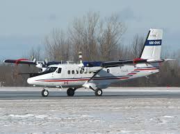
 Twin Otter |
| Survey Equipment | Survey Info | Data Type(s) | Data Collected |
|---|---|---|---|
| radiometer | --- | Light | |
| datalogger | --- | Mooring (physical oceanography) | |
| Ponargrab | --- | Geology | |
| Secchidisc | --- | Turbidity | |
| radar | --- | Navigation | Best file with nav in ArcInfo E00 format Global positioning system (GPS) data t-1-01-lm.061 (Provisional best file) |