AKA: none
Other ID: T-1-70-VI
Status: Completed
Organization(s): U.S. Navy, General Electric Company, National Aeronautics and Space Administration, USGS, Pacific Coastal and Marine Science Center
Funding Program(s): Tektite II (MU284)
Principal Investigator(s):
Affiliate Investigator(s):
Information Specialist(s):
Data Type(s): Sampling: Geology, Visual Identification: Submersible Observations
Scientific Purpose/Goals: Rates and effects of bioturbation. Nearshore sea-level history of St. John to depths of 25 m.
Vehicle(s):
Start Port/Location: N/A
End Port/Location: N/A
Start Date: 1970-04-01
End Date: 1970-04-30
Equipment Used: core, scuba
Information to be Derived: Rate and style of bioturbation, sea-level history.
Summary of Activity and Data Gathered: Phase 1 with Clifton and Hunter for 20 days at a depth of 12 m. Phase 2 with Phillips and Bowman for 20 days.
Staff: Ed Clifton, Ralph Hunter, Larry Phillips
Affiliate Staff:
D.W. Bowman (University of Texas) - Geologist
Notes: Staff information imported from InfoBank
Ed Clifton (USGS Menlo Park) - Geologist
Ralph Hunter (USGS Menlo Park) - Geologist
Larry Phillips (USGS Menlo Park) - Geologist
D.W. Bowman (University of Texas) - Geologist
Location:
Virgin Island
| Boundaries | |||
|---|---|---|---|
| North: 19 | South: 17 | West: -66 | East: -63 |
Platform(s):
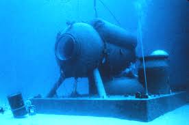 Tektite |
| Survey Equipment | Survey Info | Data Type(s) | Data Collected |
|---|---|---|---|
| core | --- | Chemistry Biology Geology | |
| scuba | --- | Submersible Observations |
