AKA: none
Other ID: T-1-96-NC,TN062
Status: Completed
Organization(s): USGS, Pacific Coastal and Marine Science Center
Funding Program(s): Strata Formations on Margins (Strataform) (MU278)
Principal Investigator(s): Homa Lee
Affiliate Investigator(s):
Information Specialist(s): Ken Israel
Data Type(s): Environmental Data: CTD, Location-Elevation: Navigation, Sampling: Biology, Sampling: Geology, Sonar: Multibeam
Scientific Purpose/Goals: STRATA FORmation on Margins (STRATAFORM) was initiated in 1994 by the Office of Naval Research as a coordinated multi-investigator study of continental-margin sediment transport processes and stratigraphy. The program is investigating the stratigraphic signature of the shelf and slope portions of continental margins, and hopes to provide better understanding of the sedimentary record and better prediction of strata.
Vehicle(s):
Start Port/Location:
End Port/Location:
Start Date: 1996-07-13
End Date: 1996-07-18
Equipment Used: boxcore, pistoncore, CTD, GPS, Kastencore, multibeam
Information to be Derived: cores were analyzed using a multi-sensor core logger, yielding P-wave velocity, wet bulk density, and magnetic susceptibility data. Atlas Hydrosweep multibeam echosounder bathymetric data, gridded at 2.16" (~60m) resolution. This system is designed for surveys in continental shelf areas down to depths of 4000 m with a swath width of up to 6 times the water depth, with an operating frequency of kHz. It provides 160 beams.
Summary of Activity and Data Gathered: 20 box cores, 12 piston cores, and 3 Kasten cores, along with 4 CTD casts.
Staff:
Affiliate Staff:
Notes: From Western Region Marine and Coastal Surveys Bulletin, July 12, 1996... CORING ON THE HUMBOLDT SLUMP Ken Israel and Homa Lee are aboard the new (and big!!!) R/V Thomas Thompson on our way from San Diego to the STRATAFORM area on the Eel River Margin and then on to Eureka. Our plans are to take box and piston cores on the slope in an area that has been described as a giant submarine slump (Humboldt Slump). Last summer a beautiful swath-bathymetry map of the area was produced, and ever since we have been trying to explain all the features we observe on the map. We hope the coring will help. There are more ex-USGS employees on the cruise than present ones. Mark Holmes and Byron Ruple are aboard, and the ships master is Captain Al. The weather is good and the whales are out. -- Homa Lee and Ken Israel From Western Region Marine and Coastal Surveys Bulletin, July 26, 1996... RECEIVED JULY 17 FROM THE THOMPSON We have just finished 4 days of intense box and piston coring in the STRATAFORM area off Eureka. We obtained 12 piston cores, each of which is about 7 m long. We also obtained 21 box cores, one at each of the piston stations plus a few more. We are finding some turbidites and lots of gas in some of the piston cores. Mark Holmes has been a tremendous help to us. Food is good and the Thompson rides great. We are doing a one-day Hydrosweep survey of the deeper areas west of the STRATAFORM area today, and we go to Eureka to unload tomorrow. Cheers, Homa Lee and Ken Israel
Staff information imported from InfoBank
Homa Lee (USGS Western Region) - Chief Scientist
Location:
Northern California
| Boundaries | |||
|---|---|---|---|
| North: 41.11943 | South: 40.65532 | West: -124.587 | East: -124.35742 |
Platform(s):
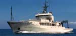 Thomas G Thompson |
Mayer, L., Fonseca, L., Pacheco, M., Galway, S., Vicente Martinez, J., Hou, T., Orange, D., Gulick, S., Yun, J., Gardner, J.V., Dartnell, P., Lee, H., and Cutter, R., 2002, The STRATAFORM GIS: University of New Brunswick, Office of Naval Research.
Minasian, D.L., Lee, H.J., Locat, J., Orzech, K.M., Martz, G.R., and Israel, K., 2001, The STRATAFORM Project: geotechnical studies: U.S. Geological Survey Open-File Report 01-190, http://pubs.usgs.gov/of/2001/0190/.
| Survey Equipment | Survey Info | Data Type(s) | Data Collected |
|---|---|---|---|
| boxcore | --- | Biology Geology | Station Information |
| pistoncore | --- | Geology | Sample request Sample request Sample request Sample request Station Information |
| CTD | --- | Surveys (geochemical) Experiments (geochemical) CTD | |
| GPS | --- | Navigation | Best file with nav in ArcInfo E00 format Global positioning system (GPS) data t-1-96-nc.060 (Provisional best file) |
| Kastencore | --- | Geology | Station Information |
| multibeam | --- | Multibeam |
