AKA: none
Other ID: T-2-74-EG,EGAL74XA
Status: Completed
Organization(s): USGS, Pacific Coastal and Marine Science Center
Funding Program(s):
Principal Investigator(s): Roland VonHuene
Affiliate Investigator(s):
Information Specialist(s):
Data Type(s): Electro-Magnetic: Gravity, Electro-Magnetic: Magnetics, Location-Elevation: Navigation, Seismics: Air Gun / Water Gun, Seismics: Sparker, Seismics: Sub Bottom Profiler, Sonar: Sidescan, Sonar: Single Beam
Scientific Purpose/Goals:
Vehicle(s):
Start Port/Location:
End Port/Location:
Start Date: 1974-09-14
End Date: 1974-09-30
Equipment Used: airgun, 3.5khz, sidescansonar, magnetics, gravity, navigation, minisparker, bathymetry
Information to be Derived:
Summary of Activity and Data Gathered:
Staff: Ken Bayer, Dan Bernhardt, Jim Bragg, Terry Bruns, Bob Mattock, Bob Patrick
Affiliate Staff:
Marty Holmes (University Of Washington) - Unspecified
Carl Von Bock - Unspecified
Kent Wohl (Blm) - Unspecified
Gerald Reid (U.S. Fish and Game) - Unspecified
Karen McElvey (Shoreline J.C.) - Unspecified
Beth Chiodo (Shoreline J.C.) - Unspecified
Jim Raeny - Unspecified
Notes:
Staff information imported from InfoBank
Roland Von Huene (USGS Western Region) - Chief Scientist
Terry Bruns (USGS Western Region) - Unspecified
Bob Mattock (USGS Western Region) - Unspecified
Ken Bayer (USGS Western Region) - Unspecified
Bob Patrick (USGS Western Region) - Unspecified
Marty Holmes (University Of Washington) - Unspecified
Carl Von Bock - Unspecified
Dan Bernhardt - Unspecified
Kent Wohl (Blm) - Unspecified
Gerald Reid (U.S. Fish and Game) - Unspecified
Karen McElvey (Shoreline J.C.) - Unspecified
Beth Chiodo (Shoreline J.C.) - Unspecified
Jim Bragg - Unspecified
Jim Raeny - Unspecified
Location:
Eastern Gulf of Alaska
| Boundaries | |||
|---|---|---|---|
| North: 60.14833 | South: 58.83815 | West: -146.575 | East: -140.09998 |
Platform(s):
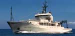 Thomas G Thompson |
Carlson, P.R., and Molnia, B.F., 1975, Preliminary isopach map of Holocene sediments, northern Gulf of Alaska: U.S. Geological Survey Open-File Report 75-0507, 8 p.
Carlson, P.R., Bruns, T.R., and Molnia, B.F., 1975, Submarine slides and near surface faults, northern Gulf of Alaska: U.S. Geological Survey Open-File Report 75-0504, 1 p.
Carlson, P.R., Molnia, B.F., and Bruns, T.R., 1976, Preliminary study of sea-floor instability in offshore Gulf of Alaska Tertiary Province: American Association of Petroleum Geologists Bulletin, v. 60 no. 4, pp. 655–655.
Carlson, P.R., and Molnia, Bruce F., 1976, Submarine mass movement of Holocene sediments seaward of the Copper River: U. S. Geological Survey Circular 0733, pp. 55–56.
Carlson, P.R., and Schwab, William C., 1982, Northern Gulf of Alaska environmental geology, in Bruns, T. R., ed., Hydrocarbon resource report for proposed OCS lease sale 88; southeastern Alaska, northern Gulf of Alaska, Cook Inlet, and Shelikof Strait, Alaska: U.S. Geological Survey Open-File Report 82-0928, pp. 73–86.
Carlson, P.R., Bruns, Terry R., Molnia, Bruce F., and Schwab, William C., 1982, Submarine valleys in the northeastern Gulf of Alaska; characteristics and probable origin: Marine Geology, v. 47 no. 3-4, pp. 217–242.
Molnia, B.F., and Carlson, P.R., 1975, Base map of the northern Gulf of Alaska: U.S. Geological Survey Open-File Report 75-0506, 1 p.
Molnia, B.F., and Carlson, P.R., 1975, Surface sediment distribution map, northern Gulf of Alaska: U.S. Geological Survey Open-File Report 75-0505, 5 p.
Molnia, B.F., Carlson, Paul R., and Bruns, T.R., 1976, Report on the environmental geology, OCS area, eastern Gulf of Alaska: U.S. Geological Survey Open-File Report 76-0206, 28 p.
Molnia, B.F., and Carlson, Paul R., 1976, Surface sedimentary units of the northern Gulf of Alaska continental shelf: U. S. Geological Survey Circular 0733, pp. 56–57.
Molnia, B.F., Post, Austin, and Carlson, Paul R., 1996, Glacial-marine acoustic stratigraphy in Gulf of Alaska fiords: , Geological Society of America Abstracts with Programs. , pp. 507–507.
Steele, W.C., Degnan, C.H., Deeter, G.B., and Riordan, J.A., 1989, Description of marine geophysical data collected by the U.S. Geological Survey and how to obtain it: U.S. Geological Survey Open-File Report 89-167, 26 p., https://pubs.er.usgs.gov/publication/ofr89167.
von Huene, R., Molnia, B.F., Bruns, T.R., and Carlson, P.R., 1975, Seismic profiles of the offshore Gulf of Alaska Tertiary Province, R/V Thompson, Sept.-Oct. 1974: U.S. Geological Survey Open-File Report 75-0664, 14 p.
| Survey Equipment | Survey Info | Data Type(s) | Data Collected |
|---|---|---|---|
| airgun | --- | Air Gun / Water Gun | |
| 3.5khz | --- | Sub Bottom Profiler | |
| sidescansonar | --- | Sidescan | |
| magnetics | --- | Magnetics | Raw gradiometer data t-2-74-eg.240_050 Raw magnetics data t-2-74-eg.200 Raw gradiometer data t-2-74-eg.240 Raw gradiometer data t-2-74-eg.241 Edited gradiometer data t-2-74-eg.260_050 (Provisional best file) NGDC MGD77 data - Magnetics |
| gravity | --- | Gravity | Free Air Anomaly data t-2-74-eg.161 Free Air Anomaly data t-2-74-eg.161_050 (Provisional best file) Free Air Anomaly data t-2-74-eg.160 NGDC MGD77 data - gravity |
| navigation | --- | Navigation | Integrated navigation (SINS) data t-2-74-eg.050 (Provisional best file) Best file with nav in ArcInfo E00 format Satellite data t-2-74-eg.000 Integrated navigation (SINS) data t-2-74-eg.050_degree |
| minisparker | --- | Sparker | |
| bathymetry | --- | Single Beam | Raw depth (bathymetry) data t-2-74-eg.305 Raw depth (bathymetry) data t-2-74-eg.305_050 (Provisional best file) Sediment thickness data t-2-74-eg.340 |
