AKA: none
Other ID: T-M1-09-AR
Status: Completed
Organization(s): USGS, Pacific Coastal and Marine Science Center
Funding Program(s): Arctic bluff retreat (MU012)
Principal Investigator(s): Li Erikson, Curt Storlazzi
Affiliate Investigator(s):
Information Specialist(s): Li Erikson
Data Type(s): Sonar: Single Beam, Location-Elevation: Navigation, Environmental Data: Wave, Environmental Data: Current, Environmental Data: CTD, Time Series: Mooring (physical oceanography), Location-Elevation: LIDAR, Sampling: Geology, Environmental Data: Temperature, Environmental Data: Sediment Properties
Scientific Purpose/Goals: To obtain baseline measurements and support research contributing to the development of a predictive model of Arctic bluff retreat and inundation of barrier islands due to the a changing global climate on the North Slope of Alaska.
Vehicle(s):
Start Port/Location: Barrow, Alaska
End Port/Location: Barrow, Alaska
Start Date: 2009-08-11
End Date: 2009-08-26
Equipment Used: Echosounder-1 (Odom Echotrac CV-100), RTK GPS, Nortek AWAC, microCat, AWAC, CTD 19+ with OBS, PAR, DO, Chl, LIDAR, hand auger, thermistor, penetrometer, torvane
Information to be Derived: Waves, currents, bathymetry, sediment and bluff characteristics, suspended sediment flux, salinity and temperature, and beach and bluff topography.
Summary of Activity and Data Gathered: Collected bathymetry, elevation (foreshore), grain size (bluffs), and CTD casts.
Staff: Gerry Hatcher, Jim Allen, Thomas Reiss
Affiliate Staff:
Brian Collins (Earth Surface Processes
USGS) - Terrestrial LIDAR
Mark Savoie (Kinnetics Laboratories
Inc.) - Boat captain
Moses Nayakik - Wainwright resident
Notes: mooring AIN09F1T. Shop time includes the design and construction of bottom mounts specifically designed for the North Slope. Deployment of Trawl Resistant Bottom Mount deployed Aug. 10-25. TRBM to be recovered Sept. 22-25, 2009 Platforms used: Two vessels, ATVs, and by foot. Deployment, recovery of bottom-mounted instruments, and collection of data pertaining to bathymetry, sediments, and bluff characteristics. Study of Arctic bluff retreat and inundation of an ecologically sensitive barrier island system due to a changing global climate.
Staff information imported from InfoBank
Li Erikson (CMG, USGS) - Chief Scientist
Curt Storlazzi (CMG, USGS) - Chief Scientist
Tom Reiss (USGS) - GPS; CMG
Gerry Hatcher (CMG, USGS) - ET
Brian Collins (Earth Surface Processes, USGS) - Terrestrial LIDAR
Mark Savoie (Kinnetics Laboratories, Inc.) - Boat captain
Moses Nayakik - Wainwright resident
Jim Allen Ahmaogak (Wainwright resident) - Polar Bear Watch
Location:
Alaska
| Boundaries | |||
|---|---|---|---|
| North: 71.5 | South: 70 | West: -161.75 | East: -154 |
Platform(s):
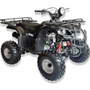
 ATV |  Boat |  on foot |
Erikson, L.H., Storlazzi, C.D., Collins, B.D., Hatcher, G.A., Reiss, T.E., and Engelstad, A.C., 2022, Hydrographic and sediment field data collected in the vicinity of Wainwright, Alaska, in 2009: U.S. Geological Survey data release, https://doi.org/10.5066/P94V9W0S.
| Survey Equipment | Survey Info | Data Type(s) | Data Collected |
|---|---|---|---|
| Echosounder-1 (Odom Echotrac CV-100) | --- | Single Beam | Single-beam bathymetry data collected in 2009 in the vicinity of Wainwright, Alaska (Bathymetry data were collected in the Wainwright Inlet, the mouth of the Kuk River, and in the nearshore region off Wainwright, Alaska, in August of 2009. Bathymetry was measured with a single-beam echo-sounder (10 Hz 144 ODOM Echotrac CV-100) mounted on the stern of a small vessel and synchronized to a 145 Real-Time Kinematic (RTK) Global Positioning Systems (GPS). The depth is measured relative to approximate Mean Sea Level (see attribute accuracy report in this file for further details on the MSL), and depth values are meters below the water surface. The GPS sampling rate was 1 Hz with vehicle speeds maintained at less than 15 km/hour, resulting in a sample point resolution of 3-5 meters. Data are available in a single csv file.) |
| RTK GPS | --- | LIDAR Transects Benchmarks Profiles Navigation | |
| Nortek AWAC | --- | Wave Current | |
| microCat | --- | CTD | |
| AWAC | --- | Mooring (physical oceanography) | |
| CTD 19+ with OBS, PAR, DO, Chl | --- | CTD | |
| LIDAR | --- | LIDAR | |
| hand auger | --- | Chemistry Geology | |
| thermistor | --- | Temperature | |
| penetrometer | --- | Geology | |
| torvane | --- | Sediment Properties | Metadata |